Beneath the canopy of western Brazil, hundreds of giant structures lay hidden from view. A team from the University of Helsinki revealed them using lidarLiDARLaser-based remote sensing (from "Light Detection And Ranging"): a sensor fires light pulses and measures the echo's return time to map a surface in three dimensions. Mounted on a plane or a drone, it slips through gaps in the canopy and reconstructs the bare-earth relief, revealing structures invisible beneath vegetation.→ -- a laser system capable of penetrating the forest cover -- in a study published on 29 July 2026 in Nature.1 These remains belong to the Aquiry civilization, active between 600 BC and 850 AD, and point to a population far larger than previously assumed.
396 geoglyphs identified by laser
Researchers surveyed 4,500 km2 of tropical forest in the state of Acre, on Brazil's border with Peru and Bolivia. Lidar fires laser pulses from an aircraft: some pass through gaps in the canopy and bounce off the ground, allowing the buried landscape to be reconstructed. Of the 432 structures that emerged, 396 were entirely unknown until now.
The shapes are remarkably varied -- circles, squares, octagons and even pentagrams -- covering an average of around three hectares each. The largest spans 50 hectares. Their ditches reach 12 metres wide and nearly five metres deep, all excavated without metal tools or draught animals.1
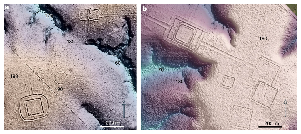
These monuments most likely served ceremonial purposes and territorial demarcation. The diversity of geometric forms revealed by the lidar data reflects a sophisticated mastery of engineering and a complex social organisation capable of coordinating enormous construction projects.
A population of 1.25 to 3 million people
The Aquiry civilization takes its name from the Acre river -- "river of caimans" in the Arawak language. Although this people occupied less than 3% of the total Amazon surface, each site required around 300 people to build and maintain. Extrapolating across all recorded monuments, the population reached between 1.25 and 3 million individuals at its peak, between 100 and 300 AD.2
The Aquiry lived in large communal houses arranged around the geoglyphs and cultivated maize, squash and manioc. They also practised elaborate agroforestry: the Brazil nuts and peach palms abundant in the region today are thought to be the result of deliberate forest management sustained over nearly 1,500 years. This botanical legacy is still detectable in the composition of the Amazon rainforest today.
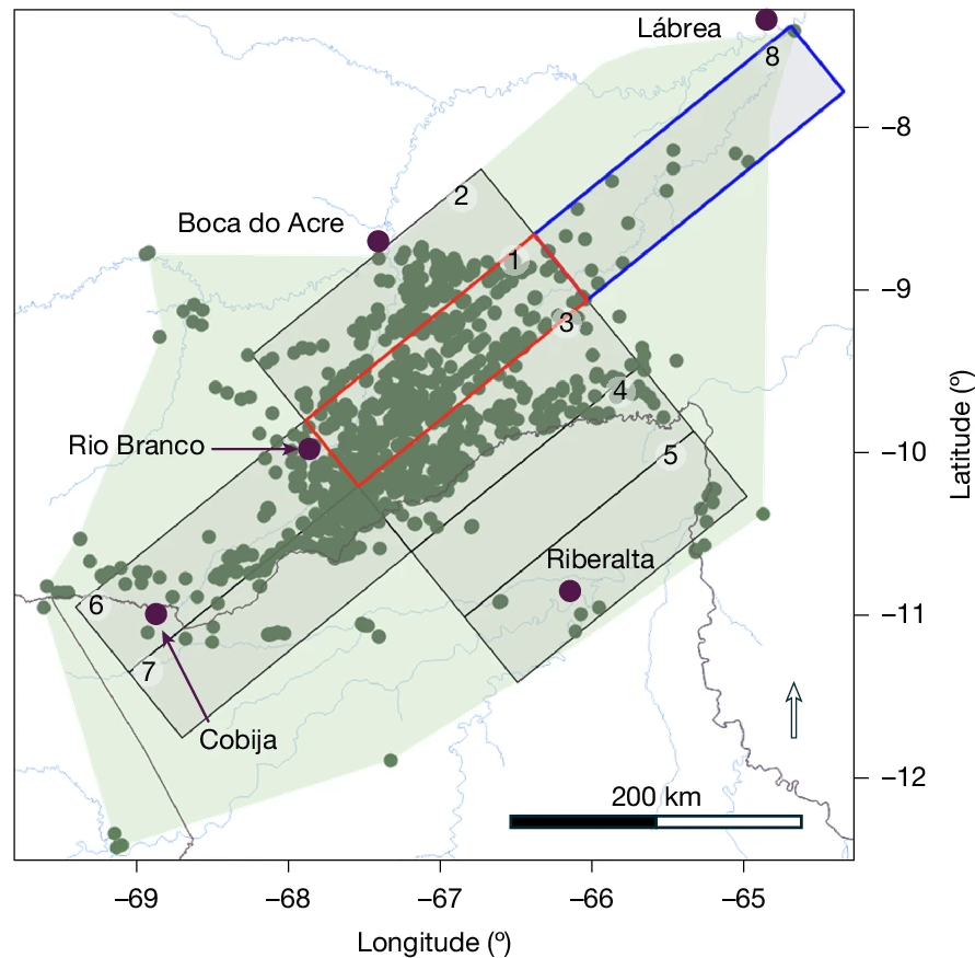
These findings challenge the long-held image of a sparsely populated pre-Columbian Amazon, and fit within a broader body of research that has, since the early 2000s, been revealing complex, densely inhabited societies beneath the tropical canopy.
A mysterious collapse around 850 AD
Between 850 and 950 AD, construction of these monuments abruptly ceased. This chronology coincides with the decline of other major American civilisations: the Classic Maya in Central America, and the Tiwanaku and Wari civilisations in the Andes. No common cause has yet been identified with certainty.1
The abandonment of the geoglyphs did not, however, mean the end of all human presence. Later communities built mound villages in parts of the same territory. Archaeologists speak of cultural transformation rather than total disappearance. The jungle reclaimed most of the remains within a few centuries, preserving them until ground surveys began in the 1990s.
20,000 to 30,000 structures still buried
The authors estimate that between 20,000 and 30,000 structures remain buried beneath the Amazon vegetation. Only a tiny fraction of the Amazon basin has been covered by lidar surveys to date. Martti Parssinen, archaeologist at the University of Helsinki, emphasises that this ancient human imprint still shapes the composition and biodiversity of the modern tropical forest.3
The results open new perspectives on the capacity of pre-colonial Amazonian societies to transform their environment durably, and on the scale of the civilisations yet to be discovered beneath the canopy.
No comments yet. Be the first.