It took only an aerial photograph and a few dark patches in a field of cereals to reopen a forgotten chapter of Irish prehistoryPrehistoryThe span of human history before the invention of writing, from the Palaeolithic to the Metal Ages, known mainly through material remains.→. In 2026, a team from Queen's University Belfast announced the discovery, in south Belfast, of the traces of a stone circleStone circleA NeolithicNeolithicThe "New Stone Age": a period marked by farming, herding, settlement and pottery, from around 10,000 BC.→ or Bronze Age monument of standing stones set in a ring, often ritual or astronomical in purpose.→ roughly 4,000 years old, raised at the turn of the Late Neolithic and the Bronze AgeBronze AgeA protohistoric period following the Neolithic, defined by bronze metallurgyMetallurgyThe techniques of extracting and working metals (copper, bronze, gold); its rise in the Eneolithic and Bronze Age transformed tools, weapons and social hierarchies.→ (a copper-tin alloy) and the rise of the first cities and states; in Egypt it corresponds to the age of the first pyramids.→. The monument had lain invisible beneath ploughed soil, a few hundred metres from another stone giant well known to locals, the Giant's Ring. What captured attention far beyond Northern Ireland is that this dig was not carried out by specialists alone, but with the help of volunteers and schoolchildren wielding trowels, one of whom unearthed a Bronze Age arrowhead.1
A discovery born from a view of the sky
It all began with a glance from above. While examining aerial images of the Ballynahatty area in County Down, archaeologist Brian Sloan, of the Centre for Community Archaeology at Queen's University Belfast, noticed a series of crop marks tracing a regular figure in a field. These differences in the colour and height of the cereals betray the presence, below the surface, of buried structures that alter the way roots draw up water. Where the ground was once dug to plant stones or posts, vegetation grows differently, and these variations, imperceptible at ground level, can be read from the air.2
What the image revealed exceeded the team's expectations. The layout suggested that the great monumental complex of Ballynahatty extended much farther than had been thought. Sloan then gathered a team of volunteers and students to probe the ground. The first trenches confirmed the hunch, the marks corresponded to a stone circle, a type of monument characteristic of late prehistory in Britain and Ireland. Cautious, the archaeologist noted that no evidence of burialBurialThe intentional deposition of a body, sometimes with offerings; a marker of symbolic behaviour.→ had yet been found, leaving open the question of the site's exact function.3 The method perfectly illustrates modern archaeology, in which aerial survey, geophysics and conventional excavation work together to reconstruct entire landscapes.
Ballynahatty, a sacred landscape thousands of years old
The new circle does not appear in a vacuum, it belongs to one of the densest ritual complexes in Northern Ireland. The Ballynahatty complex gathers some fifty monuments spread across the southern end of the Malone Ridge, beside the River Lagan. This clustering is no accident, prehistoric communities accumulated here, over centuries, mounds, enclosures and alignments, gradually turning this corner of countryside into a genuine geography of the sacred.1
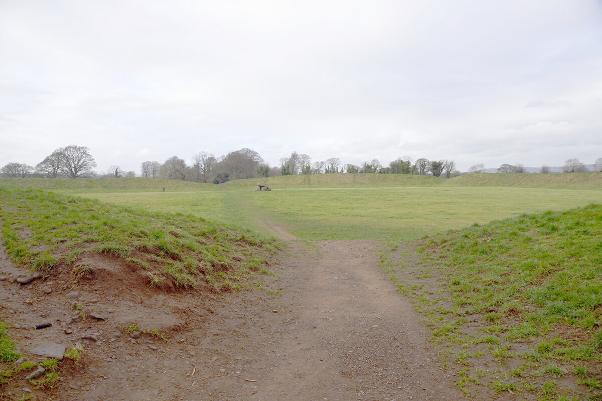
The centrepiece of this landscape remains the Giant's Ring, an enormous circular enclosure about 180 metres in diameter, ringed by an earthen bank more than 3 metres high, at the centre of which stands a chambered megalithMegalithA large stone raised or assembled by humans (menhirMenhirA stone erected vertically by humans, standing alone or in rows (alignments), emblem of the Breton Neolithic megalithic tradition. From Breton men (stone) and hir (long).→, dolmenDolmenA megalithic funerary structure made of one or more capstones resting on vertical uprights, often topped by an earth tumulus. From Breton dol (table) and men (stone).→, stone circle), typical of the Neolithic and Bronze Age.→, a dolmen-type tomb. In the 1990s, excavations led by Barrie Hartwell, then at Queen's University, revealed nearby the remains of a vast Neolithic timber temple, a complex of post circles that archaeologists interpret as a place for processing the dead, where bodies were exposed and prepared before their passage to the afterlife. The newly identified stone circle thus joins a palimpsest of monuments built, reworked and frequented for more than a millennium, from the Neolithic into the heart of the Bronze Age.
Schoolchildren at the heart of the dig
What makes this project distinctive lies as much in what it produced as in how it was conducted. The operation is part of the Community Archaeology Programme Northern Ireland (CAPNI), a participatory archaeology programme run by Queen's University and supported by the National Lottery Heritage Fund. Its ambition is twofold, to advance scientific knowledge and to make local people active custodians of their own heritage. In the field, this meant that alongside the students and researchers stood volunteers of all ages and whole classes from Belfast primary schools.4
The most talked-about moment of the campaign will remain the discovery, by a pupil named Harper from Finaghy Primary School, of a broken arrowhead around 4,000 years old. This object, tiny yet rich in meaning, is a reminder that these ceremonial places were also lived-in spaces, where people hunted, left offerings and sometimes abandoned tools. For the archaeologists, the children's enthusiasm is no trifle, it may well be the next generation of excavators, and above all it roots the monument in a community's memory. To see a child hold in her hand an object shaped by a Bronze Age hunter, on the very ground where it was lost, produces a leap across time that no textbook could ever match.
This model of community archaeology is growing rapidly in the United Kingdom and Ireland. It responds to a double crisis, that of research funding and that of the bond between the public and a heritage often seen as remote. By handing the trowel to residents, these programmes multiply the eyes and the hands, but above all they turn neighbours into watchful guardians of sites sometimes threatened by urban sprawl or intensive farming. One archaeologist's phrase sums up the spirit of the project, you have no idea what lies beneath your feet.4
What is a Bronze Age stone circle?
A stone circle is a megalithic monument made of standing blocks arranged in a circular or oval plan, sometimes on their own, sometimes combined with mounds, alignments or tombs. In Ireland and Britain, such structures appear from the end of the Neolithic, around 3000 BCE, and multiply in the early Bronze Age, roughly between 2500 and 1500 BCE. They do not form a single category, their dimensions range from a few metres to more than a hundred metres across, and the number of stones, their size and their arrangement differ from one region to another.5
Contrary to a widespread notion, these circles were probably not simple decorative enclosures. Researchers see them rather as gathering places with a ceremonial purpose, where scattered communities came together on fixed dates to mark time, honour ancestors, sealSealA small engraved object (often steatite) used to stamp a mark in clay; the Indus seals, bearing animals and signs, attest to administration and trade, though their script remains undeciphered.→ alliances or celebrate the agricultural cycles. Some circles enclose burials or deposits of cremated bone, others do not, as the Ballynahatty case appears to suggest. This diversity is a reminder that prehistory drew no sharp line between the religious, the social and the funerary, and that a single monument could combine several functions over the generations.
The Irish Bronze Age, which opens around 2500 BCE, sees the introduction of copper and then bronze metallurgy, an alloy of copper and tin. Ireland, rich in copper ore and gold, becomes an actor in the exchange networks running through Atlantic Europe. This new prosperity is accompanied by intense monument building, and stone circles rank among the most visible expressions of this spiritual and social ferment. The arrowhead found at Belfast belongs precisely to this horizon, that of farming and herding communities who already mastered metal while carrying on ceremonial traditions inherited from the Neolithic.
Ritual, alignments and reading the sky
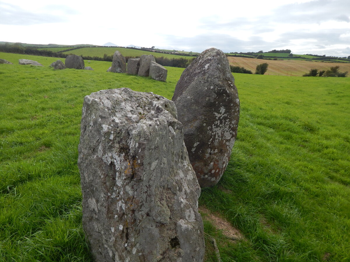
To grasp what an active stone circle might have been, one must turn to the best-preserved sites in Northern Ireland, starting with Beaghmore, in County Tyrone. Discovered in the 1930s during peatPeatA waterlogged organic soil formed by accumulated plants; it seals and remarkably preserves wood and ancient remains.→ cutting, this exceptional complex comprises seven interconnected stone circles, about ten alignments and a dozen burial cairns, more than 1,200 standing stones in all, attributed mostly to the early Bronze Age.5
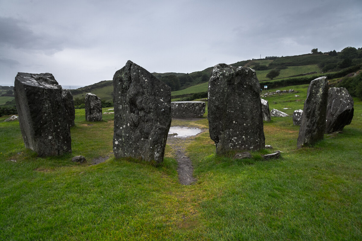
At Beaghmore, several researchers have proposed that the circles and stone rows served as an observatory or celestial calendar, some alignments pointing to sunrise at the summer solstice, others seemingly linked to the phases of the Moon and its extreme positions. Without falling into the idea of a learned and systematic astronomy, it is now accepted that these monuments organised space around visual and calendrical markers, articulating the rhythms of the sky, of the seasons and of farming work. The site, set in wetland near watercourses, shows how thoroughly stone, water and land were staged to create places of gathering and remembrance.
It is still unknown whether the Belfast circle featured such alignments, since it is too levelled for its full plan to be easily reconstructed. But its insertion into an already oriented ritual complex, close to an enclosure and a tomb, invites us to consider it in the same logic, that of monuments conceived as points of contact between the world of the living, that of the dead and the order of the cosmos. That is the whole value of comparing sites with one another, what Ballynahatty has lost, Beaghmore lets us imagine.
A monument mutilated in the nineteenth century
If the Belfast circle escaped notice for so long, it is partly because it was dismantled. Brian Sloan stressed that the monument was disturbed in the nineteenth century, when local farmers cleared away sites that hindered the cultivation of their fields. The standing stones, obstacles to the plough, were toppled, torn out or moved, leaving in the ground only the socket pits, the cavities where the blocks were once held in place. It is precisely these pits, filled with darker soil, that traced the crop marks spotted from the air.3
This fate is far from exceptional. Thousands of megalithic monuments have vanished over the last two centuries, victims of agricultural expansion, quarries, roads and urbanisation. Beaghmore itself resurfaced only thanks to peat cutting, which brought back structures thought to be lost. Every recovered circle is therefore both a stroke of luck and a warning, that of the fragility of a buried heritage of which an immense part has already disappeared without trace. The value of the Ballynahatty dig is that it scientifically documents what survives before the plough erases it for good.
What the discovery teaches us
Beyond the charming story of trowel-wielding schoolchildren, the uncovering of a stone circle at Ballynahatty has real scientific significance. It confirms first of all that the ritual complex extends more widely than had been thought, and that the sacred landscape of south Belfast remains very largely to be explored. Each newly identified monument sharpens our understanding of how the populations of the Late Neolithic and the Bronze Age shaped, over centuries, a coherent, hierarchical and meaning-laden territory.2
The discovery also illustrates the power of non-destructive methods. Without aerial photography, this circle would have remained unknown, dissolved into the ordinariness of a field. Survey from the air, now complemented by drones, laser remote sensing (LiDARLiDARLaser-based remote sensing (from "Light Detection And Ranging"): a sensor fires light pulses and measures the echo's return time to map a surface in three dimensions. Mounted on a plane or a drone, it slips through gaps in the canopy and reconstructs the bare-earth relief, revealing structures invisible beneath vegetation.→) and geophysics, is revolutionising landscape archaeology by revealing, without a single spade stroke, structures that generations of walkers had trodden over without seeing. The excavation itself comes only afterwards, to check, date and understand.
Finally there is the human dimension, the one that went around the media. By bringing together researchers, volunteers and children, the CAPNI project reconciles science and society, and conveys, better than any speech, the idea that the past belongs to everyone. The little arrowhead held up by a Finaghy schoolgirl is worth, in its own way, as much as the grand narratives, it proves that beneath the most ordinary surface, within reach of a trowel, still sleeps the deep memory of prehistoric Ireland. The analyses to come, radiocarbon dating and a close study of the circle's plan, will no doubt refine its age and its function. One thing is already certain, the Ballynahatty landscape has not finished yielding its secrets.
J'ai recommandé ce site à trois collègues. On en parle maintenant pendant les pauses.
Je cherchais des informations fiables sur ce sujet. L'article tombe à pic.