On Egypt's eastern frontier, at the precise point where the Sinai desert begins to give way to the alluvial plains of the Nile delta, a discreet archaeological site had been guarding a major secret for more than three millennia: the name of a city recorded in ancient Egyptian texts, but which no one had ever been able to locate with certainty. In 2024, an Egyptian archaeological mission working at TellTellAn artificial mound formed by the accumulation of successive layers of settlement remains at the same spot, typical of the Near East. Each destruction-rebuilding event adds a stratum.→ Abu Seifi, near Qantara in the Ismailia governorate, uncovered a 3,200-year-old stone inscription mentioning Horus as "Lord of the City of Mesen". This epigraphic discovery could well be the key that Egyptologists had been waiting for decades to definitively locate one of the most important strongholds in the Ramesside fortification network along the Way of Horus.
The announcement was made by Egypt's Ministry of Tourism and Antiquities, under Minister Sherif Fathy. The excavations are under the direction of Hesham Hussein, Director General of Delta and Sinai Archaeology. While specialists remain cautious -- definitive confirmation will require ceramic analysis and additional converging archaeological evidence -- the inscription already constitutes a remarkable milestone in the history of exploration of ancient Egypt's eastern frontier.
Tell Abu Seifi: the "Eastern Gate" of Ancient Egypt
Tell Abu Seifi is an archaeological mound located in the Qantara East area, on the eastern bank of the Suez Canal. This geographical sector occupies an absolutely unique strategic position: it is through here that the land route linking Egypt to the LevantLevantA region of the eastern Mediterranean Near East (Israel, Lebanon, Syria, Jordan), a major crossroads of the first human migrations out of Africa.→ and Mesopotamia has passed since antiquity. In the Pharaonic period, this route bore the name "Way of Horus" (also called the "Road of Horus" or the "Way of the Philistines" in later biblical texts), and constituted the most-travelled invasion and trade route between northeastern AfricaAfricaThe cradle of humankind: the continent where the first hominins appeared, then Homo sapiens around 300,000 years ago, before the expansion to the rest of the world.→ and the Fertile CrescentFertile CrescentAn arc-shaped region of the Near East (Levant, Mesopotamia) where farming and herding first emerged.→.
The site of Tell Abu Seifi has been known to archaeologists and historians since the nineteenth century. European expeditions that crisscrossed the northern Sinai at the end of that century identified the area as a potentially important site, due to the presence of Egyptian ceramics and architectural remains. However, systematic excavations did not truly begin until recent decades, when modern investigative methods -- aerial photography, ground-penetrating radar, sediment analysis -- made it possible to grasp the real extent of the site and its archaeological potential.
Recent excavation campaigns have revealed a complex stratigraphyStratigraphyThe study of the superimposed layers (strata) of an archaeological site; each layer corresponds to a phase of occupation and yields a relative chronology.→, covering several historical periods. The oldest levels correspond to the Ramesside period (19th-20th Dynasties, approximately 1295-1069 BCE), but later occupations dating from the Ptolemaic, Roman, and Byzantine periods have also been identified. It is precisely this superposition of occupations that has made excavation difficult: Roman-era constructions have partly destroyed or covered the Pharaonic levels, forcing archaeologists to work with particular patience and precision.
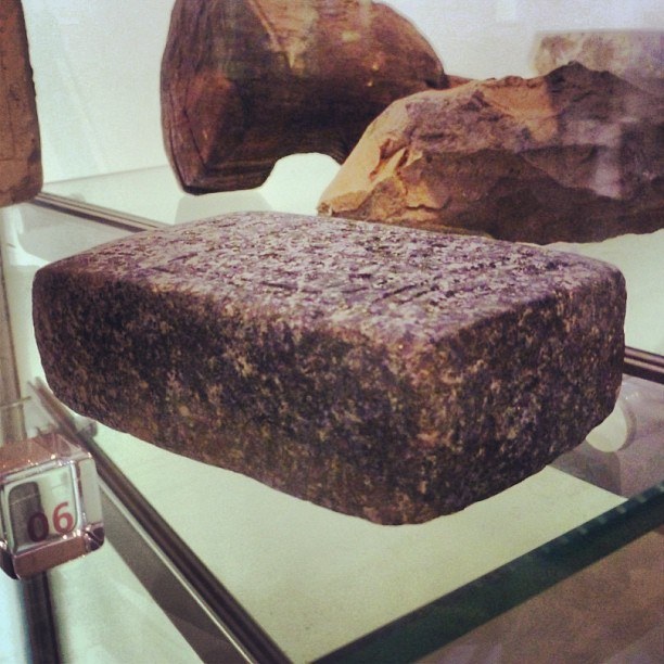
The general configuration of the site corresponds to what Egyptologists call a "border fort" or "forward outpost": an architectural complex centred around a temple dedicated to a protective deity -- here Horus -- with interlocking military, administrative, and commercial functions. This type of site is well documented along the Way of Horus, notably through reliefs in the hypostyle hall of Karnak temple executed under the reign of Seti I (Ramesses II's father), which represent the fortresses of the eastern frontier as nodes in a sophisticated logistical network.
The Way of Horus: The Military Highway of Ramesside Egypt
To understand the discovery at Tell Abu Seifi, it is essential to place the site within the geopolitical context of New Kingdom Egypt, and particularly of the 19th Dynasty. The Way of Horus is a military and commercial route approximately 250 kilometres long, connecting the Tharis region (Tell el-Borg) at the eastern edge of the Nile delta to the city of Gaza, passing through northern Sinai. This route follows the Mediterranean coast, taking advantage of the rare but vital water sources that punctuate the Sinai desert.
Under the New Kingdom, and particularly under the reigns of the Pharaohs of the 19th and 20th Dynasties (approximately 1295-1069 BCE), Egypt invested massively in fortifying this route. The Pharaohs -- particularly Seti I and Ramesses II -- ordered the construction of a series of fortresses, wells, granaries, and temples that could logistically support military campaigns in Canaan and Syria. These installations also served to control population movements, collect transit duties, and monitor the nomadic peoples of the Sinai.
The most complete documentary source on this fortification network consists of the reliefs in the hypostyle hall of Karnak temple executed under Seti I. These geographical scenes, discovered and deciphered by generations of Egyptologists, schematically represent the forts of the Way of Horus with their hieroglyphic names, their garrisons, and associated water points. It is in this list that the name of Mesen appears -- or at least a city whose name begins with the root "ms" or "msen" -- without researchers having been able, until now, to identify its exact location on the ground.
The importance of this fortification network extends far beyond simple military defence. The forts of the Way of Horus were also administrative centres, storehouses for provisions, redistribution points for water and food for troops on the march, and places of worship where soldiers could honour the protective gods of Egypt before entering enemy territory. Each fort was dedicated to a particular deity -- often Horus, but also Seth, Ramesses himself divinised, or Amun -- and had its own temple, even if these temples were often modest in size compared to the great Theban sanctuaries.
The Inscription That Identifies Mesen
It is in this context that the 2024 discovery at Tell Abu Seifi takes on its full significance. Archaeologists uncovered a stone fragment -- most likely sandstone or limestone -- bearing a hieroglyphic inscription explicitly mentioning Horus as the "Lord of the City of Mesen". The ancient Egyptian formulation uses the term "nb niwt Msn", which can be literally translated as "lord of the town of Mesen" or "master of the city of Mesen". This title is characteristic of the epithets attributed to the tutelary deities of major Egyptian cities, where each city had its patron god whose prestige it carried.
The inscription appears to refer to the restoration of a divine statue -- a common practice in Pharaonic Egypt, where statues of the gods were periodically renovated, re-gilded, or replaced, often during royal anniversaries or religious festivals. This type of "commemorative" text is particularly valuable for historians, as it provides not only a relative date (the reign of the PharaohPharaohThe title of the ruler of ancient Egypt, regarded as a living god guaranteeing cosmic order (Maat), supreme head of state, army and worship.→ mentioned), but also information about the local religious hierarchy, the status of the temple concerned, and the material resources allocated to the cult.
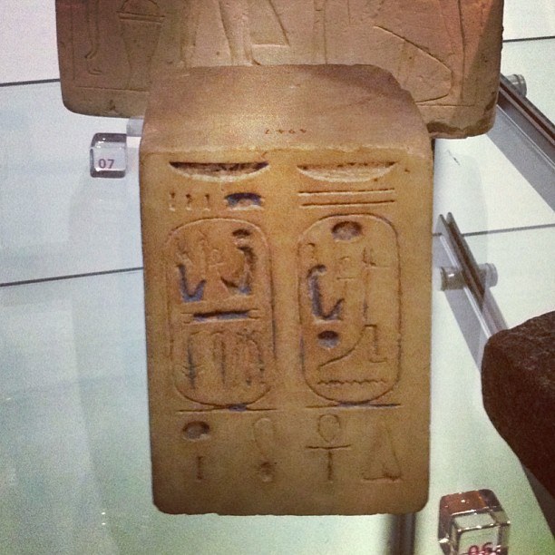
The inscribed fragments explicitly mentioning Ramesses II provide a very precise chronological bracket: this Pharaoh reigned from 1279 to 1213 BCE, an exceptional reign of 66 years that saw the construction of some of the most imposing monuments of ancient Egypt. The 19th Dynasty, of which he is the most famous representative, is a period of great architectural and military activity. It is under Ramesses II that the famous Battle of Kadesh takes place (around 1274 BCE), considered the first great battle in history for which we have a detailed account from both sides. It is also under his reign that military installations along the Way of Horus are generalised.
The presence of his cartouche at Tell Abu Seifi is therefore not a surprise in itself -- but the specific mention of Mesen as a city under the protection of Horus, combined with the geographical location of the site, makes this inscription a first-rank element for knowledge of Egypt's eastern frontier. For the first time, Egyptologists have a concrete and well-supported candidate for the location of Mesen.
Ramesses II and the 19th Dynasty: The Great Builder of Frontiers
Understanding the discovery at Tell Abu Seifi requires pausing on the personality and political programme of Ramesses II, whose name continues to appear in the inscriptions uncovered at the site. Ramesses II (in ancient Egyptian: Ramesses Meryamun, "Ramesses, beloved of Amun") is one of the most prolific and long-lived Pharaohs in all Egyptian history. Son of Seti I and Houy, he acceded to the throne in 1279 BCE and governed Egypt for more than six decades, until his death in 1213 BCE at an advanced age -- perhaps 90 years or more.
His construction programme is staggering: the Temple of Abu Simbel in Nubia, carved directly into the living rock; the Ramesseum (his mortuary temple near Luxor); the Temple of Beit el-Wali; the massive additions to the temples of Karnak and Luxor; the colossi of Memphis. All of Egypt still bears the mark of his reign. But it is perhaps on the eastern frontier that his action is most strategically coherent. Conscious of the threats weighing on Egypt from the east -- the HittitesHittitesBronze Age people who founded a powerful empire in central Anatolia in the 2nd millennium BC, skilled in rock-cut architecture and defence.→ to the north, the Sea Peoples expanding westward, the nomadic tribes of the Sinai -- Ramesses II invested massively in fortifying and consolidating Egypt's eastern limes.
The fortresses of the Way of Horus, of which Mesen was a part, were not mere military outposts. They functioned as genuine border cities: administrative centres capable of managing population flows, collecting taxes and transit duties, supplying armies on campaign, and ensuring communication between central Egypt and its possessions in the Levant. The presence of a temple in each fortress was not merely a pious gesture: the temple was also the economic centre of the fort, redistributing offerings and resources in the form of salaries for priests, officials, and soldiers.
Temple Architecture: Paved Roads and Storage Facilities
In addition to the inscription, excavations at Tell Abu Seifi revealed several particularly significant architectural elements. Archaeologists uncovered two stone-paved roads, whose orientation and construction are typical of the processional approaches to New Kingdom Egyptian temples. These roads, generally flanked by sphinxes or divine statues in the great Theban complexes, served both as ritual pathways during religious festivals and as everyday circulation axes within the complex.
The presence of such paved roads at Tell Abu Seifi is an important indicator of the scale of the cultic complex that existed at this site. One does not build expensive paved roads for a simple guard post: their presence suggests a temple of some importance, with regular festivals and solemn processions. In the context of the Way of Horus, such a temple would have received soldiers departing for the Levant, who came to seek divine protection before crossing the Sinai desert.
The storage rooms and service spaces also uncovered correspond exactly to the standard Egyptian architectural model for frontier temples. These "magazines" (the Egyptian technical term is "kherep"), arranged in batteries along the temple enclosure wall, served to store grain, oils, textiles, and other commodities offered to the god or destined for the maintenance of the temple staff. Their systematic organisation reflects the administrative precision of Pharaonic Egypt, where each temple functioned as an autonomous economic unit capable of meeting its own needs.
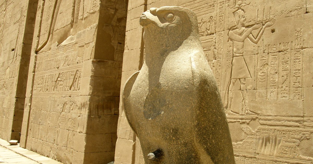
The combination of these architectural elements -- paved roads, storage rooms, service spaces -- with epigraphic inscriptions mentioning Horus "Lord of Mesen" and the cartouche of Ramesses II paints a coherent portrait of a cultic and administrative complex on Egypt's eastern frontier. This type of site corresponds exactly to what historians and Egyptologists had hoped to find to identify Mesen: a medium-sized religious centre associated with a military and commercial border post, under the direct patronage of the Egyptian crown.
Mesen in Ancient Texts: A Phantom City for 3,200 Years
One of the reasons the discovery at Tell Abu Seifi is so significant lies in the long and frustrating history of searching for Mesen in textual sources. The city of Mesen -- or "Msn" in Egyptian hieroglyphics, which does not write vowels -- appears in several ancient text corpora, including the Karnak reliefs already mentioned, but also in administrative papyri and geographical lists dating from the New Kingdom.
The difficulty partly stems from the very nature of the sources: Egyptians had no cartography in the modern sense of the term. Their geographical lists (called "onomastica" by specialists) enumerate cities and important sites in linear fashion, often in an order that follows an itinerary or administrative logic rather than a spatial representation. To identify where Mesen was actually located, it was therefore necessary to cross-reference several types of sources: geographical lists, commemorative inscriptions, administrative papyri, and field archaeological data.
Since the nineteenth century, several Egyptologists have proposed locations for Mesen. Some have identified it with sites in the Qantara region, others have searched for it further north, near Tell el-Borg or Pelusium. Others have suggested that Mesen was not a single site but a regional denomination, designating an area rather than a specific city. These divergent interpretations have maintained Mesen in the status of a "phantom city": mentioned in texts but elusive on the ground.
The Tell Abu Seifi inscription potentially changes the situation, providing for the first time a direct attestation of the name "Mesen" at the site itself, rather than in a text produced elsewhere. This coherence between the epigraphic source and the archaeological context is exactly the type of evidence researchers were waiting for. Of course, a single inscription is not enough to definitively settle the question -- which is why Hesham Hussein and his team insist on the need to find ceramics and other converging elements -- but it constitutes the strongest lead to date.
Mapping the Eastern Frontier: Lost Cities in the Desert
Tell Abu Seifi is not the only site along the Way of Horus to have revealed its secrets recently. Since the 1990s, several archaeological missions have worked systematically on the north-Sinai corridor, with results that are progressively reconstructing the map of Egypt's eastern frontier.
At Tell el-Borg, an American mission directed by James Hoffmeier and Alan Millard uncovered several superimposed Egyptian forts, the oldest of which date to the Middle Kingdom (approximately 2055-1650 BCE). This site, identified by some researchers with the fortress of "Tharu" mentioned in the Karnak reliefs, has yielded hundreds of inscriptions, ceramic fragments, and faunal remains that make it possible to reconstruct everyday life in an Egyptian border fort.
At Tell Hebua, another Egyptian team discovered remains of what could be Tjaru itself -- the administrative capital of northeastern Egypt and the official starting point for military campaigns toward the Levant. These excavations uncovered harbour installations, warehouses, and a royal palace, testifying to the particularly important status of this site in the administrative geography of New Kingdom Egypt.
The complementarity of these discoveries is remarkable: each excavated site completes the overall picture of the fortification network of the Way of Horus. But significant gaps remained, and Mesen was one of the most frustrating, since this name appeared in crucial sources without archaeologists being able to associate it with a specific site. The discovery at Tell Abu Seifi may fill this gap -- and if so, it significantly modifies our understanding of the historical geography of the Egyptian frontier.
Roman Destruction and the Long Wait for Archaeology
One of the reasons why Tell Abu Seifi was slow to yield its secrets is the partial destruction of the site by occupants of later periods, particularly by Roman-era constructions. Roman Egypt (30 BCE - 395 CE) experienced a period of intensive construction, especially in strategic areas like the delta and northern Sinai, which constituted vital axes for supplying Rome and defending the empire's eastern frontier.
Roman engineers and soldiers did not hesitate to reuse existing building materials, including dressed blocks from the Pharaonic period. This practice of "spolium" -- the reuse of ancient materials -- was common in antiquity and contributed to the disappearance of many Egyptian monuments. At Tell Abu Seifi, Roman foundations have been identified directly above the Ramesside levels, indicating that Roman builders deliberately levelled earlier Pharaonic structures to obtain a stable foundation surface.
This partial destruction had a paradoxical effect on site conservation: Pharaonic blocks not reused by the Romans were buried under Roman backfill, preserving them for two additional millennia. It is precisely in these levels buried beneath Roman constructions that recent excavations have uncovered the most important hieroglyphic inscriptions, including the one mentioning Horus "Lord of Mesen".
The transition period between Pharaonic and Greco-Roman Egypt is often neglected in studies of the eastern frontier, but it plays a crucial role in understanding the differential conservation of sites. The forts of the Way of Horus continued to function under the Ptolemies (332-30 BCE) and under the Romans, who adapted existing infrastructures to their own defensive needs. Along the same route -- renamed "Via Maris" by the Romans -- garrisons monitored the frontier until the Arab conquest of the seventh century CE.
Investigation Methods: From Ceramics to Epigraphy
The methodology deployed by Hesham Hussein's team at Tell Abu Seifi illustrates the state of the art in contemporary Egyptian archaeology, which combines traditional approaches with modern techniques to maximise the quantity and quality of information extracted from the field.
Epigraphy -- the reading and interpretation of inscriptions -- forms the core of the discovery. Egyptian hieroglyphics are one of the best-decoded writingWritingA system of conventional signs used to fix language or information durably; its appearance (c. 3300 BC) marks, by convention, the end of prehistory.→ systems of the ancient world, thanks to two centuries of intensive research since Champollion's deciphermentDeciphermentThe reconstruction of the meaning and value of the signs of an unknown script, often from bilingual texts, repeated proper names or statistical regularities.→ of the Rosetta Stone in 1822. Today's Egyptologists can fluently read hieroglyphic and hieratic texts from all periods, enabling them to rapidly interpret inscriptions discovered during excavations.
But epigraphy alone is not sufficient, which is why Hesham Hussein insists on the need to analyse ceramics. Ceramics are the most precise and most abundant dating tool available to Near Eastern ancient archaeology. Egyptian potters of each period produced specific forms, pastes, and decorations that specialists can identify with remarkable precision. Analysis of a site's ceramics makes it possible not only to date occupation levels, but also to trace commercial exchanges, cultural influences, and historical ruptures.
Other techniques have also been employed at Tell Abu Seifi: drone photogrammetry, which creates precise 3D models of excavated structures; ground-penetrating radar survey, which detects buried structures without excavation; and isotopic analysis of building materials, which can provide information on the origin of stones and supply networks. These methods, combined with classic stratigraphic excavation, have provided an increasingly complete picture of the site and its evolution over time.
The scientific caution shown by Hesham Hussein is representative of the rigour characterising modern Egyptology. At a time when "sensational" media announcements can overshadow the nuances of scientific research, Egyptian researchers choose to present their results conditionally, highlighting what remains to be confirmed. This honest approach does honour to the discipline, even if it may seem frustrating to the lay public awaiting definitive conclusions.
Implications for Egyptology: The Eastern Frontier Revisited
If the location of Mesen at Tell Abu Seifi is confirmed by ongoing analyses, the implications for our understanding of Egypt's eastern frontier will be significant. Identifying this site will make it possible to "anchor" on the map the other cities mentioned in the same textual sources, establishing relative distances and directions between the different points of the fortification network.
In the field of Egyptian historical geography, each certain identification of a site with an ancient name creates a series of cascading effects: other sites mentioned in the same texts can be more precisely located; ancient routes and itineraries can be reconstructed; and historical events mentioned in textual sources can be anchored in a concrete geographical context. The identification of Mesen would be one of those cartographical milestones that reconstruct an entire portion of the geographical puzzle of ancient Egypt.
For historians of the New Kingdom in particular, the discovery has direct implications for understanding Ramesses II's military campaigns in Canaan and Syria. The Way of Horus was not only a communication axis: it was also the logistical backbone of the Egyptian empire in Asia. Understanding how this fortification network was organised -- which sites it contained, how far apart they were, what their storage and garrison capacities were -- is essential for reconstructing Egyptian military operations in the region.
The discovery is also important for the history of Egyptian religion. The title "Horus Lord of Mesen" is not merely a geographical designation: it identifies a particular form of the falcon god, adapted to the local cults of the eastern frontier. Egyptian gods existed in hundreds of local forms, each with their own attributes, festivals, and myths. Reconstructing the form of Horus venerated at Mesen will shed light on the local theology of this frontier site and its place in the broader Egyptian religious system.
Prospects: Future Excavations and Definitive Confirmation
The 2024 excavation campaign is only a stage in a research programme that should continue for several years. The team directed by Hesham Hussein plans to continue excavations at Tell Abu Seifi, focusing on areas of the site not yet excavated -- particularly the peripheral sectors of the temple, where additional inscriptions and architectural elements may be uncovered.
Analysis of the ceramics collected during excavations is ongoing, and results should confirm (or refute) the dating of the different occupation levels and establish whether the continuity of site occupation corresponds to the periods when Mesen is mentioned in texts. Ceramics from the Ramesside levels will be compared with ceramic assemblages from other Way of Horus sites, such as Tell el-Borg and Tell Hebua, to establish typological and chronological correlations.
Geophysical surveyGeophysical surveyTechniques (magnetometry, radar) detecting buried structures underground without digging, by measuring physical anomalies.→ of the subsurface surrounding the site will likely be intensified in future campaigns, to identify the real extent of the underlying architectural complex. Ground-penetrating radar and magnetometry methods today make it possible to map buried structures over large areas without excavating them, allowing archaeologists to concentrate their efforts on the most promising zones.
International collaborations are envisaged with universities and research institutions in Europe and North America specialised in New Kingdom Egypt and Near Eastern historical geography. These collaborations will bring complementary expertise -- in palynology (analysis of ancient pollens), zooarchaeology (study of animal remains), physical anthropology -- that will enable an even more complete picture of everyday life at this frontier site.
Egypt's Contemporary Archaeological Policy
The discovery at Tell Abu Seifi fits within a broader context of revival and professionalisation of Egyptian archaeology, under the direction of the Ministry of Tourism and Antiquities. For several years, Egypt has chosen to assert the priority of Egyptian missions over their own heritage, while maintaining active collaborations with foreign scientific institutions.
Minister Sherif Fathy has made the communication of archaeological discoveries a priority of his cultural policy. The promotion of Egyptian excavations in the international media -- sometimes criticised by specialists who consider announcements premature -- responds to a logic of promoting cultural tourism and revaluing national heritage. This approach has its limits, particularly when discoveries are announced before scientific analyses are completed, but it has also helped to raise global public awareness of the richness and diversity of Egypt's archaeological heritage.
Hesham Hussein, Director General of Delta and Sinai Archaeology, embodies a new generation of Egyptian archaeologists trained at Cairo and Alexandria universities, but also at European and American institutions. His scientific caution in presenting the Mesen discovery -- insisting on the need for confirmation through ceramics -- shows that methodological rigour is not incompatible with public communication of archaeological results.
Protecting archaeological heritage in the Suez Canal zone presents a particular challenge, due to the enormous pressures that economic development places on these sites. The Suez Canal is one of the world's most important commercial arteries, and the surrounding area is experiencing rapid economic and industrial expansion. Preserving sites like Tell Abu Seifi in this context is both a scientific imperative and a major political issue, requiring close coordination between archaeological authorities, urban planners, and economic operators.
Horus and the Eastern Frontier: Theology and Geopolitics
It is difficult to overestimate the symbolic importance of Horus in the context of Egypt's eastern frontier. In Egyptian theology, Horus is simultaneously the celestial falcon god, son of Osiris and Isis, and the divine incarnation of the living Pharaoh. Every king of Egypt is Horus on earth, the victorious hero in the eternal struggle against the forces of chaos represented by Seth. This identification between king and god is not merely spiritual: it has profound political and military implications.
Placing a border fortress under the protection of Horus "Lord of Mesen" is not an arbitrary choice. It is a theological and geopolitical declaration: the soldiers guarding this frontier are the soldiers of Horus, and by extension of the Pharaoh himself. Enemies who dare to cross this frontier are not merely challenging Egypt: they defy the divine will. This symbolic dimension was deeply feltFeltA non-woven fabric made by pressing and matting wool fibres; steppe nomads used it for rugs, saddles and appliqués, remarkably preserved in the frozen Pazyryk tombs.→ in a society where the boundary between the sacred and the profane did not exist in modern terms.
The local form of Horus associated with Mesen -- "Horus Lord of Mesen" -- fits within a pantheon of local forms of the same god that populated the religious geography of Egypt. At Edfu, he was "Great Horus"; at Hierakonpolis, "Horus of Nekhen"; in the delta, "Horus of Behdet". Each of these forms had its own local myths, its own annual festivals, and its own iconography. The discovery of the epithet "Horus Lord of Mesen" thus opens a window onto the local theology of the northeastern frontier, a domain on which documentation was until now very fragmentary.
The Karnak reliefs representing the forts of the Way of Horus show a tutelary deity above each corresponding fortification. These representations are not mere decorations: they literally map the network of divine protection that the 19th Dynasty Pharaohs deployed along their eastern frontier. Mesen may appear there in a form that Egyptologists had not yet been able to identify with certainty, for lack of knowing the corresponding site. The discovery at Tell Abu Seifi could enable these reliefs to be re-read with fresh eyes, finally associating a concrete geographical position with the divine representations depicted there.
Tell Abu Seifi in Its Regional Archaeological Context
Tell Abu Seifi does not exist in isolation. It is part of a dense archaeological landscape along the northern Sinai corridor that has been progressively mapped over recent decades through a series of Egyptian and international excavations. Understanding the site's place within this regional context is essential for grasping the full significance of the Mesen identification.
The northern Sinai corridor was one of the most intensively occupied regions of the ancient Near EastNear EastA region of western Asia (Levant, Mesopotamia, Anatolia, Iran), cradle of the Neolithic revolution, agriculture, the first cities and writing.→. Its relative geographical narrowness -- bounded by the Mediterranean to the north and the central Sinai massif to the south -- meant that virtually all land traffic between Egypt and the Levant was funnelled through this zone. This concentration of traffic created, over the millennia, a series of overlapping archaeological deposits that record the passage and settlement of successive civilisations, from the ChalcolithicChalcolithicThe "Copper Age": a transition between the Neolithic and the Bronze Age, marked by the first copper objects (Ötzi's era).→ period through the Bronze AgeBronze AgeA protohistoric period following the Neolithic, defined by bronze metallurgy (a copper-tin alloy) and the rise of the first cities and states; in Egypt it corresponds to the age of the first pyramids.→, the Iron AgeIron AgeThe last period of protohistory (from c. 1200 BC in Europe and the Near East), marked by iron metallurgy and the first kingdoms.→, and into the historical periods.
Ramesses II's fortification programme was not built in a vacuum: it incorporated and reinforced earlier infrastructure dating from the Middle Kingdom and early New Kingdom. Several sites along the Way of Horus show evidence of multiple phases of construction, with Ramesside structures built directly atop Middle Kingdom foundations. This palimpsest of occupation makes excavation technically challenging but archaeologically extraordinarily rich, as each phase of construction can potentially reveal information about a different period of Egyptian history.
The discovery of the Mesen inscription therefore needs to be understood not merely as the identification of a single site, but as a piece in a much larger puzzle of regional settlement patterns, military organisation, and religious geography. When placed alongside the results from Tell el-Borg, Tell Hebua, and other Way of Horus sites, the Tell Abu Seifi findings begin to sketch the outlines of a coherent territorial system -- a network of interconnected points that together constituted Egypt's living eastern frontier.
Future regional surveys will likely reveal additional sites in the gaps between the known forts, providing an even more granular picture of how this frontier operated in practice. Remote sensing technologies, including satellite imagery analysis and airborne LiDARLiDARLaser-based remote sensing (from "Light Detection And Ranging"): a sensor fires light pulses and measures the echo's return time to map a surface in three dimensions. Mounted on a plane or a drone, it slips through gaps in the canopy and reconstructs the bare-earth relief, revealing structures invisible beneath vegetation.→ surveys, have already demonstrated their capacity to detect buried archaeological sites beneath the sands of the northern Sinai. Applied systematically to the entire corridor, these technologies could transform our understanding of ancient Egypt's most strategically critical border region, with Tell Abu Seifi and its newly identified Mesen inscription serving as a key anchor point for this broader geographical reconstruction.
Conclusion: A Discovery That Rewrites Ramesside Geography
The uncovering of the inscription mentioning Horus "Lord of the City of Mesen" at Tell Abu Seifi is far more than an epigraphic curiosity. If confirmation occurs -- and current evidence is solidly grounded -- it will represent a major contribution to our knowledge of ancient Egypt's eastern frontier, the historical geography of the New Kingdom, and the organisation of the fortification network of the Way of Horus.
For Egyptologists, this discovery offers a remarkable example of how combined approaches -- classical stratigraphic excavation, epigraphy, ceramic analysis, geophysical survey -- can enable identification and characterisation of sites mentioned in ancient texts but previously elusive on the ground. It also confirms that Egypt's eastern frontier, despite decades of research, still holds many secrets that future excavation campaigns will progressively decipher.
For the general public, the discovery of Mesen illustrates in a striking way the persistence of the past in the landscapes of the present. Beneath the sands of northern Sinai and the alluvium of the Nile delta, the remains of a civilisation more than three millennia old wait patiently to be brought to light. Each additional year of excavation reveals a little more of this vanished world -- and sometimes, as in 2024 at Tell Abu Seifi, gives a name to a phantom city that had inhabited ancient texts for 3,200 years.
There is something profoundly human in the long search for Mesen. For Egyptologists and archaeologists of the Near East, a city name in an ancient text is not simply a string of hieroglyphic signs: it is a promise that somewhere, beneath the soil, the material traces of real people -- soldiers, priests, merchants, scribes -- are waiting to be found. The Tell Abu Seifi inscription fulfils part of that promise. It connects the textual world of the Ramesside scribes who listed the forts of the Way of Horus to the physical reality of a site that can now be visited, excavated, and studied. In doing so, it reminds us that behind every name in an ancient list, there is a story waiting to be told -- and that the work of archaeology is, at its heart, the work of restoring those stories to the people of the present.
No comments yet. Be the first.