A buried circle betrayed by the peat of Machrie Moor
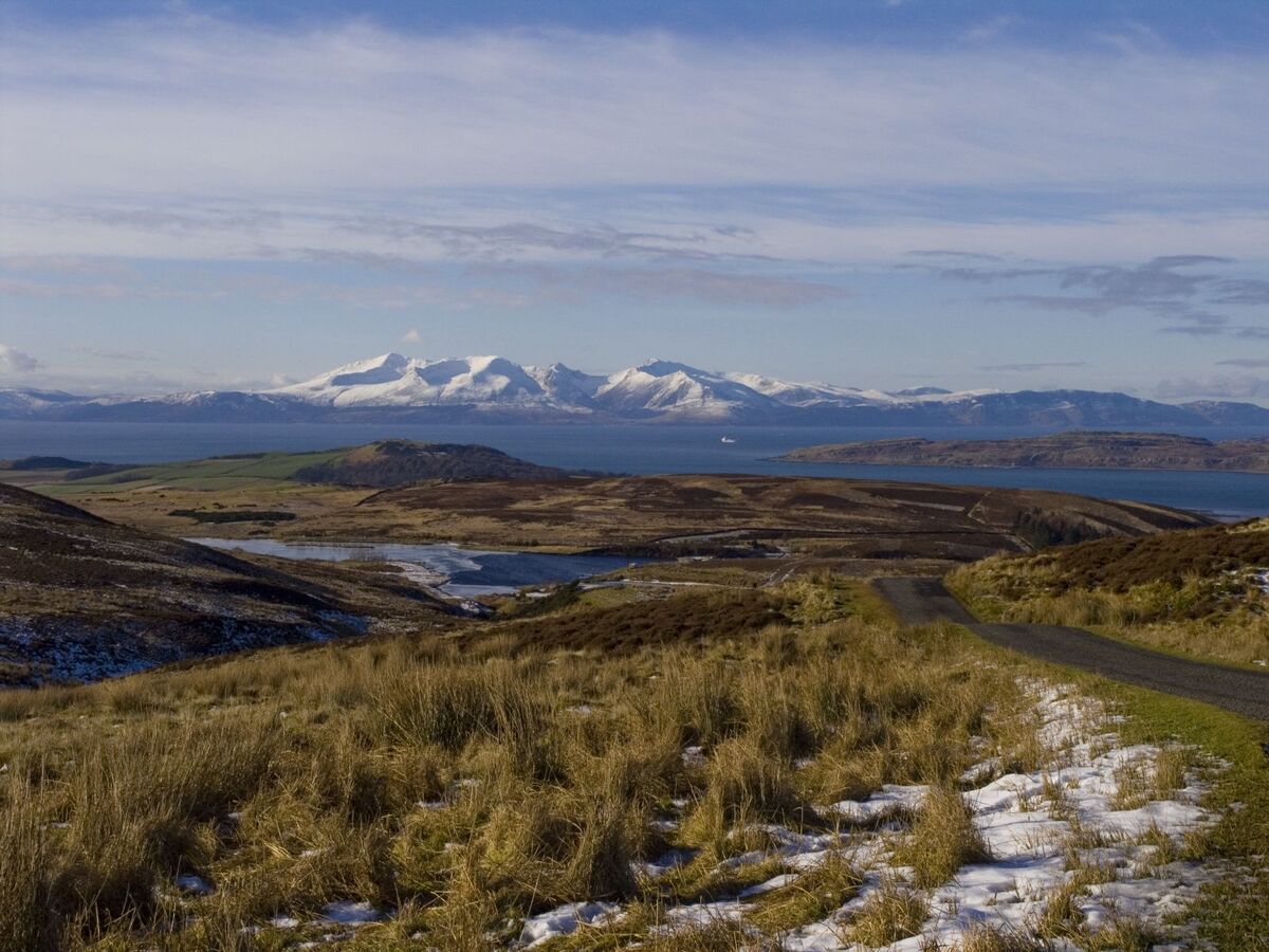
On the Isle of Arran, off the western coast of Scotland, the moor of Machrie Moor has long sheltered one of the most celebrated ritual landscapes of British prehistoryPrehistoryThe span of human history before the invention of writing, from the Palaeolithic to the Metal Ages, known mainly through material remains.→. On 30 June 2026, Historic Environment Scotland announced that a new element had quietly joined this already spectacular ensemble: a possible stone circleStone circleA Neolithic or Bronze AgeBronze AgeA protohistoric period following the Neolithic, defined by bronze metallurgy (a copper-tin alloy) and the rise of the first cities and states; in Egypt it corresponds to the age of the first pyramids.→ monument of standing stones set in a ring, often ritual or astronomical in purpose.→ or timber circle, entirely buried beneath the peaty moorland, revealed not by the spade but by the instruments of a team that, originally, was looking for nothing of the sort1. The structure, long invisible to the naked eye, lay dormant under a thick blanket of waterlogged vegetation, only a few hundred metres from the standing stones that made the site famous.
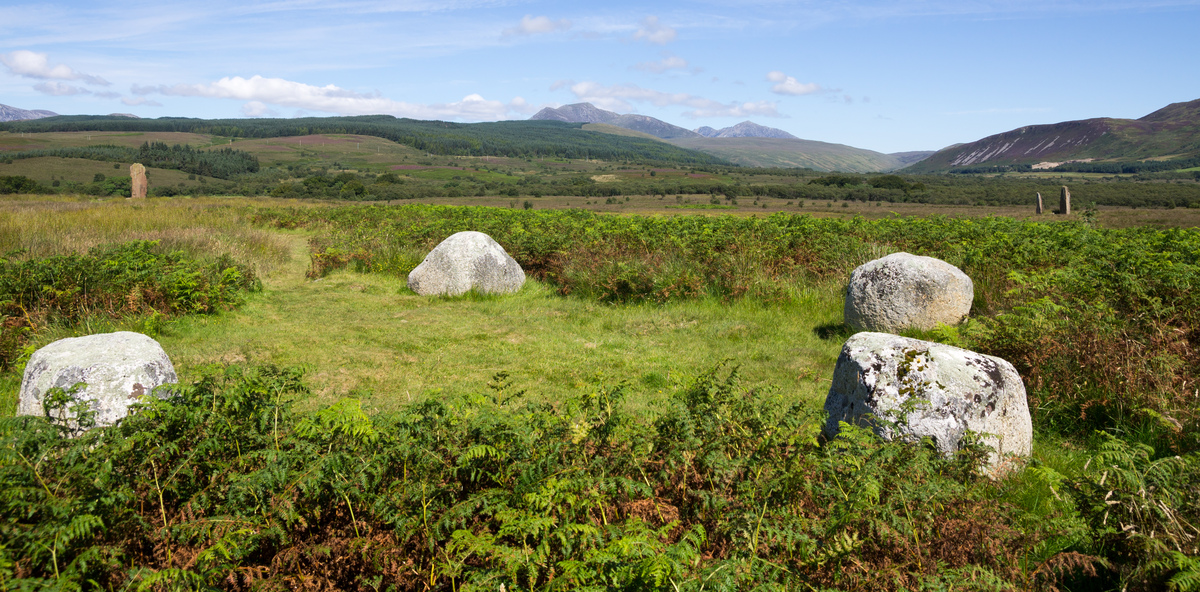
Historic Environment Scotland, the public body responsible for protecting Scotland's heritage, stresses caution: this is a "possible" circle, whose exact nature and age remain to be confirmed. Yet the mere prospect of an additional monument, until now overlooked by generations of archaeologists, is enough to rekindle interest in a moor thought to have been mapped down to its smallest corners. The discovery illustrates a truth now familiar to contemporary archaeology: what escapes the eye has not necessarily vanished, and the most studied landscapes still conceal surprises beneath their most superficial layers.
A discovery born of a simple instrument test
The story of this find is in part one of methodical chance. The archaeologists had not come to Machrie Moor to unearth a new monument: they wanted to test the effectiveness of survey equipment on notoriously difficult ground, peat2. Peaty soils, saturated with water and rich in organic matter, often blur signals and complicate the interpretation of surveys. The site therefore offered an ideal testbed: a context reputed to be unforgiving, yet backed by already known prehistoric structures that served as reference points. In checking the sensitivity of their instruments, the researchers were above all hoping to calibrate a method that could be reproduced elsewhere across the Highlands and the islands.
It was during this calibration exercise that the data delivered far more than a mere technical check. Where the team expected reference measurements, the instruments traced the regular outline of a buried circular structure, invisible at the surface. This kind of accidental discovery is no isolated anecdote in the history of the discipline: many major sites have been located because a survey intended for an entirely different purpose suddenly revealed an anomaly too regular to be natural. At Machrie Moor, the irony is plain: the test of a tool produced a scientific result whose significance far exceeds the methodological validation initially sought.
For Historic Environment Scotland, the episode also serves as a demonstration. It confirms that non-invasive geophysical surveyGeophysical surveyTechniques (magnetometry, radar) detecting buried structures underground without digging, by measuring physical anomalies.→ can work in peaty terrain, provided the right sensors are used and one knows how to read attenuated signals. This validation opens a concrete prospect: applying the same approach from now on to other Scottish moors, where comparable monuments might slumber beneath equivalent blankets of peat, hidden from view and from excavation.
What the geophysics revealed beneath the moor
The survey was carried out by magnetometry, wheeling the sensors just above the ground, without digging or removing so much as a single clod3. This technique measures minute variations in the local magnetic field, caused by buried disturbances: filled pits, hearths, backfill or structures whose fill differs from the surrounding soil. At Machrie Moor, the instrument detected twelve circular anomalies, distributed along a pattern that owes nothing to chance. These twelve magnetic patches are arranged in a ring roughly 28 metres in diameter, each anomaly separated from the next by a regular interval of about 6.5 metres.
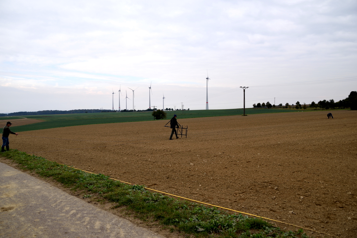
The regularity of this spacing is one of the most telling clues. Such an orderly arrangement, on a near-perfect circle, matches what is expected of a monument built by human hands, not the random scattering of natural blocks or geological disturbances. Specialists read each of these twelve anomalies as the trace of a pit, that is, the spot where a vertical element was once planted: a timber post or a standing stone. The fill of these pits, different from the original subsoil, is enough to betray their presence under magnetometry, even millennia after they were dug.
One detail both complicates and enriches the reading: among the twelve anomalies, two wide gaps interrupt the regularity of the ring. Researchers estimate that these voids could correspond to two additional pits, now vanished or undetectable, which would bring the original count to fourteen upright elements. The monument would then have counted fourteen posts or stones forming a complete and symmetrical circle. This hypothesis remains to be verified, but it illustrates how a geophysical image is read as much in its presences as in its absences: the gaps in a pattern can say a great deal about what has been erased.
Timber or stone: a question still open
One question now dominates the discussion: what was this circle made of? The detected anomalies show no characteristic sign of stone. Yet a buried mineral mass generally produces a recognisable magnetic signature, different from that of a pit simply filled with earth. The absence of such a signal allows two complementary interpretations, which geophysics alone cannot settle.
First possibility: the monument was a timber circle, formed of tall posts planted in the detected pits. These posts, once gone through rotting, would have left only the ghost of their packing holes, filled with sediment distinct from the surrounding soil. Such timber circles are well documented in British and island prehistory, where they sometimes precede or accompany stone circles. They form a category of monument in their own right, often linked to ritual and funerary practices. Second possibility: the circle was indeed of stone, but its blocks were removed afterwards, reused or displaced over the centuries, leaving behind only the empty pits of their anchoring.
This ambiguity is nothing exceptional. A single site may mix materials or change in nature across the generations, a timber circle giving way to a stone circle, or the reverse. At Machrie Moor precisely, the visible monuments already bear witness to a long history of rebuildings and transformations. Only a targeted excavation, examining the contents of the pits and the possible presence of chips, packing stones or charred organic matter, will be able to lift the doubt over the true identity of this buried circle.
Machrie Moor, a high place of the Neolithic and Bronze Age
To grasp the importance of this discovery, it must be placed in its context. Machrie Moor is no ordinary moor: it is a monumental ensemble where several stone circles, still standing or fallen, survive spread across time4. Some align tall slabs of red sandstone reaching towards the sky, others combine sandstone and granite in more modest rings. These structures, built and reworked during the NeolithicNeolithicThe "New Stone Age": a period marked by farming, herding, settlement and pottery, from around 10,000 BC.→ and the Bronze Age, belong to an island tradition of circular monuments that punctuated the landscape and, no doubt, the ceremonial life of farming communities.
The new circle would most likely date from the same period as its still visible neighbours. Nothing, for now, allows a precise date to be fixed, but its form, its dimensions and its insertion into this ritual landscape argue for belonging to the same chronological horizon, between the fourth and the second millennium before our era. If confirmed, this buried circle would enrich an already remarkable map, suggesting that Machrie Moor was a centre of ceremonial activity vaster and more complex than thought, structured by a multiplicity of monuments some of which have so far escaped all observation.
This accumulation of monuments on a single territory is not accidental. It reflects a prolonged frequentation, a collective memory attached to a specific place, reinvested generation after generation. Each added circle was in dialogue with the previous ones, extending a ritual intention that we can only glimpse. The possible presence of an additional ring, invisible and yet intact beneath the peat, reminds us that these sacred landscapes sometimes extended far beyond what their visible remains allow us to guess today.
Peat, both shroud and archive of the past
If the circle was able to elude the eye for so long, it is thanks to the peatPeatA waterlogged organic soil formed by accumulated plants; it seals and remarkably preserves wood and ancient remains.→ that covers Machrie Moor. This organic matter, formed by the slow accumulation of poorly decomposed plants in waterlogged, oxygen-poor environments, thickens at a rate of a few millimetres a year. Over millennia, it ends up burying everything resting on the ground, monuments included, beneath a continuous layer. What was visible to the builders of the circle thus disappeared, swallowed by a moor that never stopped growing.
This same peat, which hides monuments from view, also acts as a remarkable archive. Its damp, oxygen-deprived environment slows decomposition and preserves organic materials that, elsewhere, would have vanished long ago: wood, pollen, seeds, sometimes entire structures. A timber circle buried under peat could, in the best case, have preserved fragments of its posts, offering a rare opportunity for analysis and dating. The layers of peat themselves record the evolution of climateClimateThe long-term average atmospheric conditions of a region; its variations (glaciations, aridifications) shaped migrations, agriculture and the collapse of prehistoric societies.→ and vegetation, allowing the landscape to be reconstructed as it appeared to prehistoric populations.
This dual role, at once shroud and conservatory, makes peat an ambivalent partner for archaeology. It conceals, but it protects; it complicates detection, but it preserves what other soils would have destroyed. The difficulty of the Machrie Moor survey, precisely linked to the peaty nature of the terrain, is thus coupled with a promise: what the moor has hidden, it may also have remarkably preserved, sheltered from oblivion.
Caution and the next steps
Historic Environment Scotland maintains a measured tone. The circle remains "possible": geophysics has detected a coherent structure, but it cannot on its own establish its nature, its function or its date. Distinguishing a timber circle from a dismantled stone circle, confirming the hypothesis of fourteen upright elements, pinning down the chronological attribution: so many questions that will require further investigations, conducted with method and without haste.
What follows will most likely involve a combination of approaches: new high-resolution surveys to refine the underground image, then, if appropriate, targeted trial trenches to examine a few pits directly. Any excavation in a peaty environment demands particular precautions, for the waterlogged sediment is fragile and the organic materials it protects degrade quickly once exposed to the air. Caution is therefore not only scientific: it is also a conservation requirement, so as not to destroy in a single season what the peat has preserved for millennia.
Beyond Machrie Moor, this discovery carries a broader lesson. It reminds us that the best-known heritage landscapes still conceal invisible monuments, and that non-invasive methods, as they grow more refined, are changing the way we explore them. What began as a simple instrument test turned into a serious lead for rethinking a major site. The buried circle of Arran, whether of timber or of stone, already testifies to a reality archaeologists never forget: beneath the most familiar surface, prehistory has not said its last word.
J'ai recommandé ce site à trois collègues. On en parle maintenant pendant les pauses.
Parfait pour mes élèves de 5e. Je garde cet article en favori pour ma séquence préhistoire.