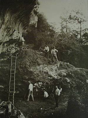
Beneath a rock shelterRock shelterA shallow cavity at the foot of a cliff or under a rocky overhang, offering natural shelter; a favoured site of prehistoric habitation and rock art.→ in the Forest of Fontainebleau, sixty kilometres south of Paris, researchers have identified what may be the oldest three-dimensional map ever found: a relief model dating back nearly 13,000 years, carved into the sandstone floor and representing the local river network of the Paris Basin. The discovery, published in the Oxford Journal of Archaeology, rewrites the history of cartography.1
The Ségognole 3 Site
The Ségognole 3 shelter, located in the Forest of Fontainebleau and known to archaeologists since the 1980s, is an Upper PalaeolithicUpper PalaeolithicThe final phase of the Palaeolithic (c. 45,000 to 10,000 years ago), marked by Homo sapiens in Europe, art, ornaments and a succession of cultures (Aurignacian, Gravettian, Solutrean, Magdalenian).→ site that has yielded rock engravings and fossil fauna. During a meticulous re-analysis of the shelter floor, geologists Médard Thiry (Mines ParisTech) and Anthony Milnes identified a structure carved into the quartzite sandstone that resembles no known natural feature. By precisely mapping the floor topography, they revealed a network of miniature channels and reliefs that corresponds remarkably to the current geography of the Seine and Essonne valleys and their tributaries.1
Before this discovery, the oldest known three-dimensional map was a Bronze AgeBronze AgeA protohistoric period following the Neolithic, defined by bronze metallurgy (a copper-tin alloy) and the rise of the first cities and states; in Egypt it corresponds to the age of the first pyramids.→ engraved rock slab dating to around 3,000 years ago. The Ségognole 3 model pushes this limit back by 10,000 years, within the context of the Late Glacial period, when Upper Palaeolithic populations had developed sophisticated material and symbolic cultures, as evidenced by the cave paintings of Lascaux or the Venus statuettes.
Spatial Thinking in the Palaeolithic
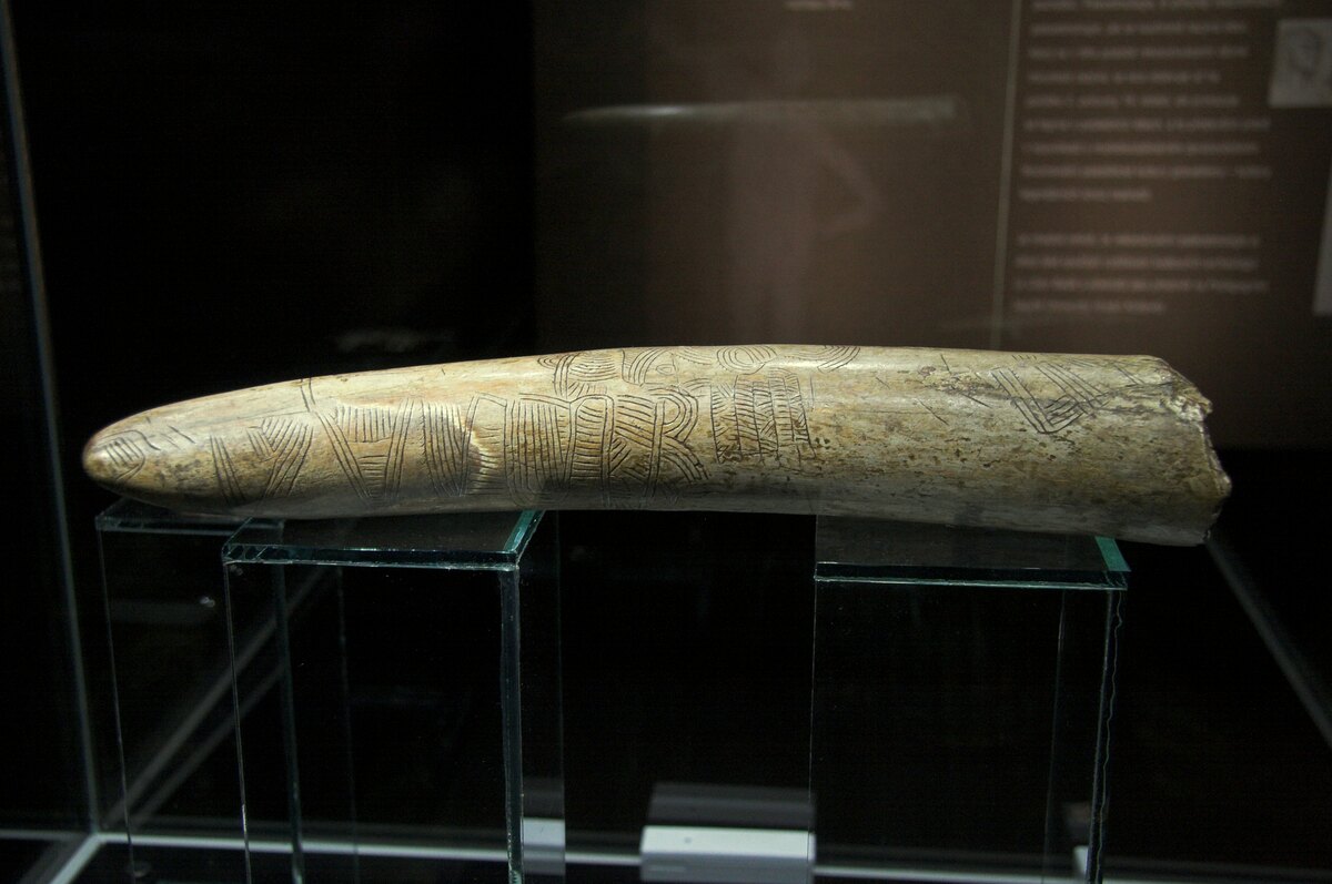
The Ségognole map is not without precedent in prehistoric archaeology. Several objects have been interpreted as spatial or cartographic representations: mammoth tusk engravings from the Gravettian, bone marks read as territorial surveys. What makes Ségognole 3 unique is its scale: a permanent three-dimensional representation carved into rock, at a relative scale that would allow practical navigation or orientation.2
This interpretation remains contested in the archaeological community. Some researchers stress the difficulty of distinguishing intentionally carved forms from natural sandstone erosion, and call for further analysis (OSL dating of sediments trapped in the engravings, traceological study of the surfaces). The paper's authors respond that the correspondence between the carved topography and the real river network is too precise to be coincidental, and that tool marks observed under the microscope exclude a natural origin.3
Prehistoric Cartographic Cognition
Whatever the outcome of the scientific debate, the discovery at Ségognole 3 illustrates a reality that recent cognitive studies confirm: Upper Palaeolithic humans possessed elaborate spatial thinking, capable of conceptualising a territory, representing it, and using it as a navigation aid or knowledge-transmission tool. This cognitive capacity, one of the foundations of all subsequent civilisations, was thus already fully operational among the hunter-gatherers of the Forest of Fontainebleau 13,000 years ago.
Ce qui me fascine c'est le lien entre représentation spatiale et abstraction symbolique. Une carte implique de pouvoir 'sortir' mentalement du territoire pour le voir d'en haut. C'est exactement le continuum cognitif dont parle Conard — et ça remet en question l'idée d'une rupture nette avec le Paléolithique antérieur.
Je connais bien Fontainebleau pour y avoir randonné plusieurs fois, mais je n'avais aucune idée de ce que cachaient certains abris rocheux. Je vais me renseigner sur les visites guidées archéologiques dans la forêt. Est-ce que le site de Ségognole 3 est accessible au public ?
Merci pour cet article ! Je travaille en ce moment sur un projet interdisciplinaire avec mes collègues de maths et d'arts plastiques sur la représentation de l'espace. Cet exemple est parfait pour montrer que la pensée cartographique ne date pas d'hier — ni même d'il y a 3000 ans.