The last continent: a riddle at the edge of the world
There was a time, not so distant on the scale of our species, when two entire continents had yet to feel the tread of a human foot. North America and South America, from the Arctic Circle to the icy reaches of Tierra del Fuego, formed a world empty of people, roamed by mammoths and giant ground sloths, wild horses and saber-toothed cats. Then, one day, hunters out of the cold crossed an invisible threshold and entered this New World. They did not know they were discovering a continent. They were surely following game, a coastline, a valley, an intuition. Within a few thousand years, their descendants had colonized two continents along their entire length, one of the fastest and most spectacular expansions in all of human prehistoryPrehistoryThe span of human history before the invention of writing, from the Palaeolithic to the Metal Ages, known mainly through material remains.→.
How and when did this happen? It is one of the most hotly debated questions in all of archaeology. For a long time, a single answer seemed to command consensus: the first Americans arrived roughly thirteen thousand years ago, descending through an ice-free corridor that opened between two immense ice sheets. This model was called "Clovis first," after a culture of mammoth hunters. But over the past three decades or so, that comfortable certainty has collapsed. Fossilized footprints, campsites far older than Clovis, fresh readings of ancient DNAAncient DNAGenetic material preserved in old remains, often degraded, sequenced with cutting-edge techniques.→: everything converges to push back the date of arrival, complicate the routes, and multiply the hypotheses. The peopling of the AmericasPeopling of the AmericasThe migrations that led Homo sapiens to occupy the American continent, from Beringia; its date and routes remain debated.→ is no longer a simple story. It is an open, thrilling worksite where solid facts and bold interpretations contest every single date.
This feature proposes to follow the thread of that investigation. From the frozen steppes of Siberia to the drowned beaches of the Pacific, from the footprints of White Sands to the campsites of Chile, we will see how researchers reconstruct one of the last great journeys of our species. We will always distinguish what is known from what is supposed, because on this terrain more than any other, caution is a method. Far from impoverishing the story, this demand for rigor is precisely what makes it so rich: every uncertainty is a door open onto new research, every contested date a spur to sharpen our methods.
One must grasp at the outset what was at stake in this journey on the scale of human history. Our species, Homo sapiensHomo sapiensThe present-day human species, which emerged in Africa around 300,000 years ago, the only surviving human lineage after the extinction of Neanderthals and Denisovans.→, was born in AfricaAfricaThe cradle of humankind: the continent where the first hominins appeared, then Homo sapiens around 300,000 years ago, before the expansion to the rest of the world.→, then spread across Eurasia, reaching Australia tens of thousands of years ago. The Americas, by contrast, remained inaccessible far longer, protected by the barrier of extreme cold and by the immensity of the ice. To settle this last great space required crossing one of the harshest environments on the planet, at the edge of Arctic Siberia, then finding a way through or around a wall of continental ice. It is no accident, then, that the Americas were the last great continent conquered by humanity. To understand this peopling is to understand how Paleolithic hunters, armed with stone and wood, overcame one of the final geographical obstacles standing in the way of our species' expansion.
Beringia: a drowned continent between two worlds
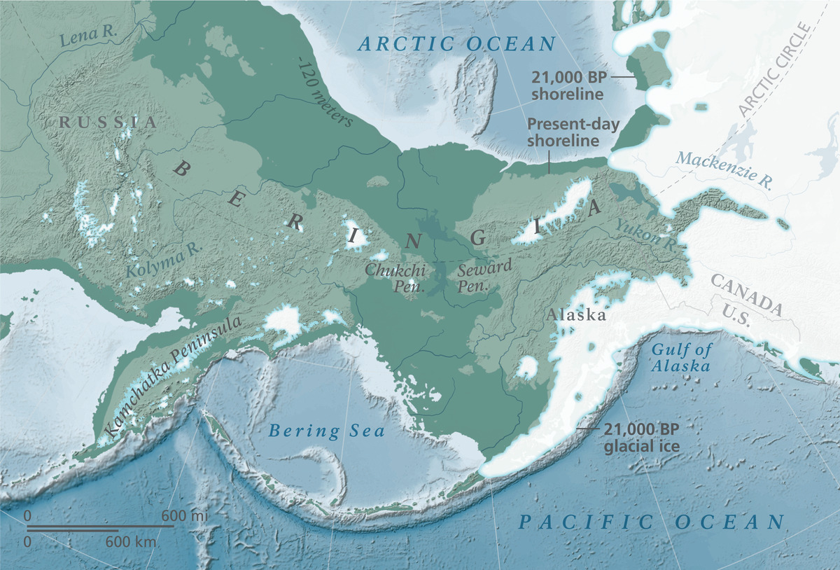
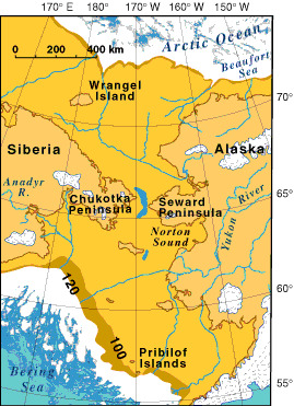
To understand the arrival of the first Americans, one must first imagine a country that no longer exists. Today, a strip of sea separates Siberia from Alaska: the Bering Strait, about eighty-five kilometers wide and shallow. But during the last glaciation, when immense volumes of water were locked up in the ice sheets, the level of the oceans dropped by more than a hundred meters. The shallow seafloor was laid bare, and a colossal land bridge emerged, nearly a thousand kilometers wide from north to south. This territory, which geologists call BeringiaBeringiaA vast land bridge emergent between Siberia and Alaska during the last glaciation, at the site of today's Bering Strait; a cold steppe through which the first Americans passed.→, joined northeast Asia to America in a single continuous mass of land.
Beringia is sometimes imagined as a desert of ice, an inhospitable no man's land. That is a mistake. This vast plain was in fact a cold, dry steppe, swept by winds but largely free of glaciers, for precipitation there was too scarce to feed ice caps. Paleontologists speak of the "mammoth steppeMammoth steppeA vast cold, dry steppe-tundra ecosystem covering glacial Eurasia, home to mammoths, woolly rhinos, reindeer, horses and bison.→": a grassy ecosystem that sustained woolly mammoths, steppe bison, horses, reindeer, and musk oxen. For cold-adapted Paleolithic hunters, this was not a barrier but a habitat, a hunting ground where one could live, move, and settle. Beringia was not a bridge to be crossed in haste. It was a country where one could dwell, a land in its own right with its rivers, its sheltered valleys, and its seasons.
This idea gave rise to one of the most fruitful hypotheses in the discipline: the "Beringian Standstill." According to this scenario, a population out of Siberia would have remained isolated in Beringia for several thousand years, cut off from Asia by the cold and from America by the ice that still blocked the passage southward. During this long pause, the group would have accumulated its own genetic mutations, a distinct signature found today in all the Indigenous peoples of the Americas. Genetics strongly supports this model: Native American lineages diverged from their Asian cousins well before spreading across the continent, which implies a prolonged period of isolation, very probably in Beringia.1
How long did this standstill last? Estimates vary, often between several centuries and about ten thousand years, and the debate remains open. But the general idea is firmly established: before they were an American people, the ancestors of Native Americans were a Beringian people, forged in the cold of a land now covered by the sea. For the end of the glaciation sealed Beringia's fate. Toward the close of the PleistocenePleistoceneThe geological epoch of the great ice ages (c. 2.6 Ma–11,700 BP), spanning most of human prehistory.→, the melting ice raised the oceans, and the plain slowly drowned. The Bering Strait closed again, swallowing beneath its waters the cradle of the first Americans. What was once a vast inhabited territory now lies beneath the Chukchi Sea, beyond the reach of excavation, which partly explains why its secrets remain so hard to uncover.
It is worth dwelling on what daily life might have looked like in this vanished country. The people of Beringia would have depended on the great herds of the mammoth steppe, tracking bison and horse across open grassland, clothing themselves in hides, and building shelters against a wind that never rested. Fire was not a comfort but a condition of survival. Fuel was scarce on a treeless steppe, so bone and dung likely served as combustibles. These were populations of formidable resilience, heirs to tens of thousands of years of adaptation to the Ice Age cold of northern Eurasia. That such people could endure, and even flourish, in so demanding a land is a reminder that the Paleolithic was not an age of helplessness but of ingenuity, of technical and social solutions honed against the harshest of environments.
White Sands: footprints that upend the chronology
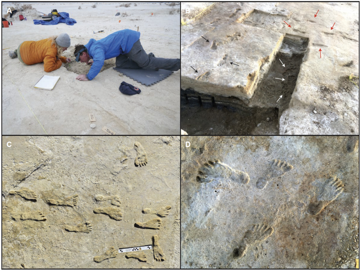
In the heart of New Mexico, within White Sands National Park, stretches an unreal landscape of gypsum dunes of dazzling whiteness. Beneath these sands once lay the shores of a vanished lake, Lake Otero, whose sediments preserved an unexpected treasure: hundreds of fossilized human footprints. Adults and children, walking, pausing, crossing paths at the water's edge. These tracks, revealed by erosion, offer a moving snapshot of prehistoric lives. But it is their dating that struck the scientific world like a bombshell.
In 2021, a team of researchers published dates obtained from the seeds of an aquatic plant, Ruppia, recovered from the layers containing the footprints. The result: these tracks would have been left between roughly twenty-three thousand and twenty-one thousand years before present. In other words, in the very midst of the Last Glacial MaximumLast Glacial MaximumThe peak of the last glaciation (c. 26,000 to 19,000 years ago), with ice sheets at their greatest extent; it pushed populations towards southern refuges.→, the coldest phase of the glaciation, when the ice sheets reached their greatest extent. If these dates are correct, humans were walking in New Mexico thousands of years before Clovis, and long before the supposed opening of any route to the south. It was an earthquake for the discipline.5
Like any extraordinary discovery, this one drew objections. Ruppia seeds, from an aquatic plant, can absorb ancient carbon dissolved in the water, which could potentially skew the radiocarbon result by making them appear artificially old. In response to this legitimate criticism, the team answered in 2023 with new, independent analyses: dates on terrestrial conifer pollen, immune to this bias, and on quartz grains using an entirely different method, optical luminescence. All three approaches agreed. In 2025, further work refined and widened the range, proposing a cautious interval extending from approximately twenty-three thousand six hundred to seventeen thousand calibrated years before present. The core of the estimate remains very ancient.
What makes the footprints so precious, beyond their age, is their very nature. A stone tool can be moved, reworked, misdated. A footprint can only be left at the exact spot and the precise instant a foot pressed into the mud. It freezes a gesture, a presence, a single second of prehistoric life. At White Sands, researchers could read whole scenes: a person perhaps carrying a child on the hip, setting it down, picking it up again; tracks of giant ground sloths and mammoths crossing those of humans, proof that people and megafauna truly shared the shores of the lake. These narratives etched into the ground give White Sands an evocative power that few archaeological sites possess.
Should the matter therefore be considered closed? No, and this must be said clearly. These dates remain debated within the scientific community. Some researchers stay cautious, noting that it would be strange to find, around footprints so old, almost no other trace of occupation, no tools, no hearths in abundance. Others, on the contrary, now judge the evidence convincing, all the more so as three independent methods point in the same direction. White Sands perfectly illustrates the nature of the current debate: a spectacular material fact, footprints that are undeniably real, but whose dating remains a matter of discussion. One thing is certain: these tracks have made it forever impossible to still believe that Clovis was the beginning of everything.
Clovis: the splendor and fall of a model
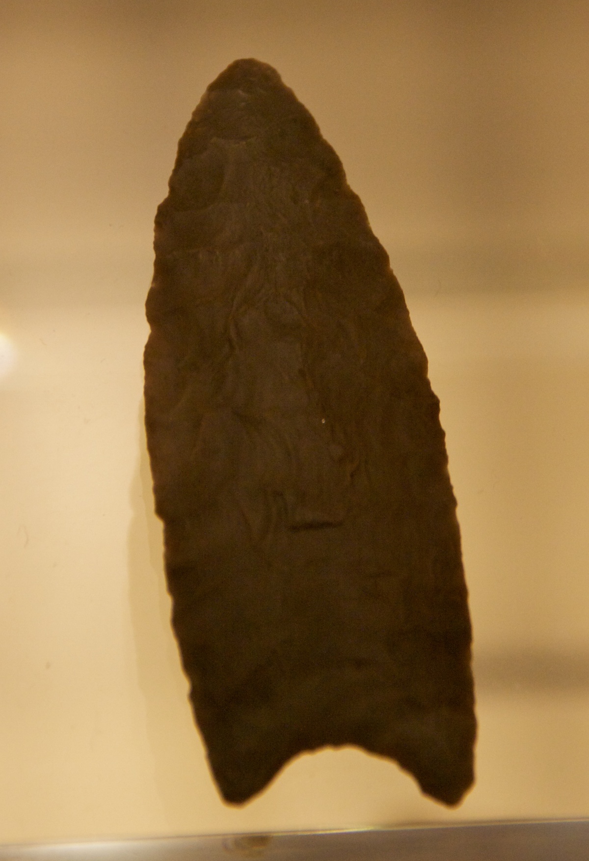
To measure the scale of the upheaval, one must return to Clovis and understand why this culture reigned over minds for so long. It all begins in the 1930s, near the small town of Clovis, New Mexico. Archaeologists there unearthed stone points of remarkable craftsmanship, associated with mammoth bones. These weapons display a unique feature: a flute, a longitudinal channel carved at the base to ease hafting onto a shaft. This fluted ClovisClovisA Palaeoindian culture of North America (c. 13,000 years ago), recognizable by its fluted stone points; long believed the oldest on the continent, no longer so.→ point would become the emblem of the first Americans. A little earlier, the discovery of Folsom points embedded in the bones of an extinct bison, near Folsom in New Mexico, had already proven the antiquity of the peopling, but Clovis would impose itself as the absolute reference.
The Clovis culture unfolds over a strikingly brief and recent span, between roughly thirteen thousand and fifty and twelve thousand seven hundred and fifty years before present, that is, approximately eleven thousand years before our era. Within a few centuries, its characteristic points appear across a vast expanse of North America. These PaleoindiansPalaeoindianRefers to the earliest human cultures of the Americas at the end of the Pleistocene, big-game hunters, including Clovis and Folsom.→ were formidable hunters, capable of bringing down mammoths and mastodons, ranging over great distances. The quality of their stoneworking, the standardization of their tools, command admiration. For decades, since no older site had been recognized beyond dispute, researchers logically concluded that Clovis represented the first wave of peopling.
From this arose the "Clovis first" model, which dovetailed with glacial geography. The scenario was elegant: Beringian hunters would have descended southward through an ice-free corridorIce-free corridorAn inland passage between the Laurentide and Cordilleran ice sheets, open and viable only around 14,000-13,000 years ago, too late for the earliest arrivals.→, a passage opening between the two great North American ice sheets, the Laurentide to the east and the Cordilleran to the west, at the moment when they began to separate. This inland corridor would have provided a land route to the fertile plains of the south, where the hunters would have prospered and spread, giving rise to the Clovis culture. It all held together, and the model dominated American archaeology throughout the second half of the twentieth century.3
And yet this fine edifice cracked, then collapsed. The problem is twofold. On the one hand, sites indisputably older than Clovis were discovered, south of the ice, which ruins the idea that Clovis came first. On the other, close study of the inland corridor showed that it became genuinely viable, with enough vegetation and game to sustain travelers, only too late, probably around fourteen thousand to thirteen thousand years ago. Too late to explain the earlier southern occupations. Clovis was therefore not the beginning of the American story, but an already advanced chapter. The culture remains magnificent and important, but it has lost its title of first arrival, and with it an entire paradigm that had structured the discipline for two generations of researchers.
The world before: the pre-Clovis revelation
If Clovis is not the beginning, who came before? The answer lies in a term now central to the discipline: pre-ClovisPre-ClovisA set of American sites older than Clovis (Monte Verde, Cooper's Ferry, etc.) that overturned the 'Clovis first' model.→. Under this heading are grouped all the archaeological sites whose human occupation predates Clovis, and which prove a presence in the Americas well before the opening of the inland corridor. For a long time, every pre-Clovis candidate was met with fierce skepticism, so powerful was the dominant model. It took sites of exceptional quality to overturn the general conviction.
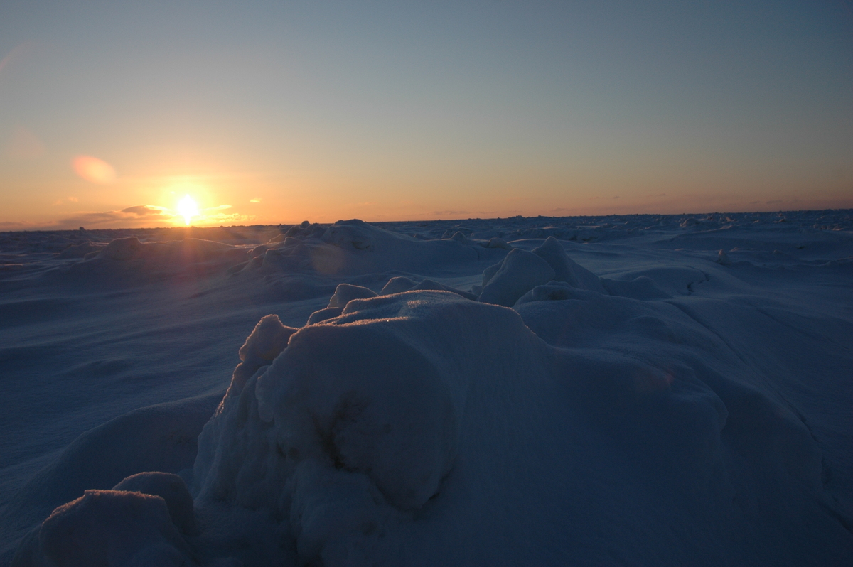
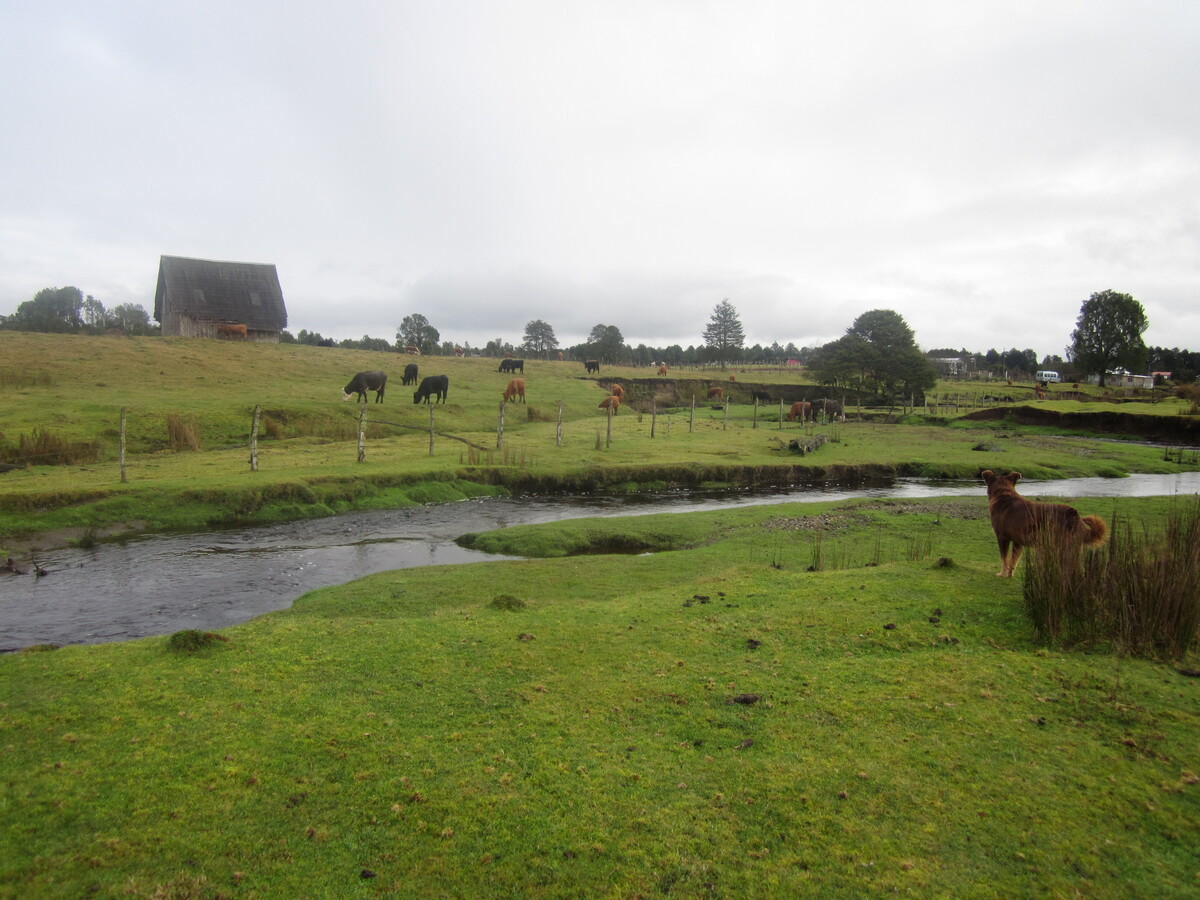
The most famous of these sites lies at the other end of the continent, in southern Chile: Monte Verde. Excavated from the 1970s onward, it yielded a human occupation firmly dated to around fourteen thousand five hundred years ago, with still older levels under discussion. Its preservation is extraordinary: in a waterlogged, oxygen-deprived soil, remains of wood, plants, cordage, hides, and even footprints survived across the millennia. The technology of Monte Verde is nothing like Clovis; these are different tools, an economy oriented toward gathering and a diversity of resources. Yet this site sits at the far southern end of the continent, thousands of kilometers from the Bering Strait. For humans to be there fourteen thousand five hundred years ago, they must have entered America far earlier, and traveled an immense distance. Monte Verde was the decisive blow struck against the Clovis first model.3
Other sites reinforced this picture. At Cooper's Ferry, in Idaho, artifacts have been dated to around sixteen thousand years ago, a remarkably early date for the North American west. At Meadowcroft, in Pennsylvania, a long-excavated rock shelterRock shelterA shallow cavity at the foot of a cliff or under a rocky overhang, offering natural shelter; a favoured site of prehistoric habitation and rock art.→ presents lower layers that appear to predate Clovis. At the Paisley Caves, in Oregon, researchers uncovered coprolites, fossilized human feces, whose analysis yielded ancient DNA attesting to an early human presence. At Gault, in Texas, beneath the Clovis layers, lie lithic assemblages of a different and older make. None of these sites, taken in isolation, closes the debate, and each has been the object of criticism. But their accumulation sketches a coherent picture: the Americas were inhabited well before Clovis.
It is worth pausing on what this scientific battle involved, for it illuminates how knowledge advances. For decades, the weight of the Clovis first model was such that presenting a pre-Clovis site amounted almost to academic suicide. Critics demanded, rightly, impeccable evidence: a reliable date, a clear stratigraphyStratigraphyThe study of the superimposed layers (strata) of an archaeological site; each layer corresponds to a phase of occupation and yields a relative chronology.→, artifacts undeniably shaped by human hands and not by nature. Many candidates crumbled under this scrutiny. This demand for rigor was not stubbornness: it served to eliminate false leads and retain only the most solid sites. When Monte Verde was finally validated, following a collective visit by skeptics who came to examine it on the spot, it was all the more convincing because the lock had been so hard to break. The fall of Clovis first is a fine example of how science eventually bends before the accumulation of facts, even against a comfortable and long-dominant paradigm.
What can be cautiously concluded? That human presence in the New World reaches back at least fifteen or sixteen thousand years by broad agreement, and perhaps much further if the White Sands dates hold. Pre-Clovis is no longer a marginal hypothesis defended by a few rebels: it is the new foundation on which the entire narrative of the peopling is being rebuilt. There remains, then, a formidable question: if these people did not pass through the inland corridor, still closed, by what route did they come?
The kelp highway: the Pacific coastal route
The most convincing answer to this riddle was long neglected, because it hides beneath the sea. It is the hypothesis of the Pacific coastal routePacific coastal routeThe hypothesis of a migration along the deglaciated Pacific coast (the 'kelp highway'), exploiting marine resources; favoured for the earliest arrivals.→, sometimes vividly nicknamed the "kelp highway." The idea is this: rather than waiting for the opening of a land corridor deep inland, the first migrants would have followed the Pacific coast, skirting the ice along the shore, exploiting the abundant resources of marine environments.
This scenario has a seductive chronological coherence. The shores of the Pacific, along Alaska and British Columbia, cleared of ice relatively early, probably around sixteen thousand years ago, well before the inland corridor became viable. And the coast offered an extraordinarily rich and steady larder: kelp forests teeming with life, fish, shellfish, seabirds, seals and other marine mammals. A population skilled in coastal travel, even in simple craft, could advance from bay to bay, from campsite to campsite, following a continuous ecosystem that scarcely changed from Siberia to California. This ecological continuity would have allowed a relatively rapid advance southward, entirely bypassing the obstacle of the ice sheets.2
The coastal route is today favored by many researchers to explain the very first arrivals, even before any use of the inland corridor. It accounts for the early dates of southern sites like Monte Verde: groups descending swiftly along the Pacific could have reached South America long before the land route opened. It also fits the image of peoples adapted to coastlines, drawing their subsistence from the sea, a skill already possessed by populations of northeast Asia accustomed to the cold shores of the North Pacific.
But this hypothesis runs into a major obstacle, almost cruel for archaeologists: the evidence is missing, and for an implacable geographical reason. The shores these migrants would have followed corresponded to the sea level of the glacial age, very low. As the ice melted, the sea rose by more than a hundred meters, drowning those ancient coasts. The campsites, hearths, and tools the first travelers might have left now lie beneath tens of meters of water, off the present-day coasts. This is what makes the coastal route so hard to prove directly: the stage on which the events unfolded has vanished beneath the waves. Underwater archaeology is now trying to recover these drowned remains, mapping ancient shorelines and sampling sediments from the seabed, an arduous quest but one full of immense promise.
Nor should the two routes be set too starkly against each other, as though one must exclude the other. The most plausible scenario, in the eyes of many researchers, combines both: an initial entry along the Pacific coast, explaining the oldest southern sites, followed later by use of the inland corridor once it became passable, for other movements of population. Great human migrationsMigrationsLong-distance movements of populations; a major driver of human history (the exit from Africa, the peopling of continents, Neolithic and steppe expansions).→ rarely follow a single, exclusive path. They branch, overlap, intersect. Some groups may have descended by sea, others by land, at different times. Thinking of the peopling in terms of multiple routes, staggered over time, accords far better with the complexity revealed by archaeology and genetics than a model reduced to a single road.
What the genes tellTellAn artificial mound formed by the accumulation of successive layers of settlement remains at the same spot, typical of the Near East. Each destruction-rebuilding event adds a stratum.→ us: the contribution of ancient DNA
Where stone and sediment fall silent, another witness has spoken up in recent years: DNADNAThe molecule carrying genetic information, used to reconstruct kinship between species.→. The study of genomes, ancient and modern, has revolutionized our understanding of the peopling of the Americas, providing clues that archaeology alone could not furnish. It confirms certain intuitions, complicates others, and adds a few mysteries of its own.
The first lesson is the clearest: the origin of the Indigenous peoples of the Americas is indeed northeast Asian and Siberian. All analyses converge on an ancestry rooted in the populations of Paleolithic Siberia. A famous milestone is provided by the genome of a child buried at the Mal'ta site, near Lake Baikal, roughly twenty-four thousand years ago. This specimen belongs to a population that geneticists call the "Ancient North Eurasians," and it revealed that a significant share of Native American ancestry derives from this group, blended with East Asian lineages. The first Americans are thus the product of an ancient admixture, occurring in Asia, between several Paleolithic populations.4
The second lesson bolsters the Beringian Standstill hypothesis. Genetic analyses show that the ancestral lineage of Native Americans split from its Asian relatives well before diversifying on American soil, with a period of isolation in between. This signature of prolonged isolation fits perfectly with the idea of a population confined in Beringia for thousands of years. Then, once the way south opened, diversification was rapid: the lineages split almost simultaneously into North American and South American branches, consistent with a lightning-fast expansion across both continents.
Finally comes the mystery. In analyzing the genome of certain Amazonian populations, researchers detected a faint but troubling genetic affinity with populations of Australasia, that is, the region encompassing Australia, New Guinea, and Melanesia. This signal, sometimes called "Population Y" or a ghost population, remains unexplained. How could an Australasian component end up in the heart of Amazonia? Several hypotheses circulate, none of them wins agreement. Here more than ever, caution is required: genetic research evolves quickly, its results are refined and sometimes corrected. What DNA tells us today may be nuanced tomorrow. But one thing is settled: the peopling of the Americas was surely more complex than a simple straight line drawn from Siberia.
A world of giants: the megafauna and its disappearance
When the first humans entered the Americas, they discovered a prodigious bestiary, a world peopled by giants of which only bones remain today. This late Pleistocene megafaunaMegafaunaThe very large animals (mammoths, giant ground sloths, etc.) of the Pleistocene, most of which became extinct at the end of the last ice age.→ rivaled that of present-day Africa in its diversity and its sheer excess. Picturing this lost world is essential to understanding the context in which these hunters lived.
The tableau is dizzying. Mammoths and mastodons roamed the plains and forests. Giant ground sloths, several meters tall when they reared up, browsed the foliage. Glyptodonts, a kind of armored armadillo the size of a small car, moved slowly beneath their shells. Saber-toothed cats, the smilodons, hunted powerful prey. Wild horses, now vanished from the very continent where their lineage had been born, galloped in herds alongside American camels and bison with immense horns. This was Paleolithic fauna in all its splendor, and the Paleoindians, with their fluted points, were its new predators.
Now, toward the end of the Pleistocene, within a few thousand years, a large part of this megafauna disappeared. Mammoths, mastodons, giant ground sloths, American horses, smilodons: all went extinct, leaving the Americas strangely stripped of their largest animals. This mass extinction coincides, disturbingly, with two major events: the arrival and expansion of human hunters on the one hand, and a large-scale climatic upheaval at the end of the glaciation on the other. Hence one of the oldest debates in American paleontology.
Two great theses confront each other, without either having definitively triumphed. The first, known as "overkill," attributes the principal responsibility to humans: naive prey, having never encountered a human predator, would have been decimated by efficient hunters spreading across entire continents. The second emphasizes climateClimateThe long-term average atmospheric conditions of a region; its variations (glaciations, aridifications) shaped migrations, agriculture and the collapse of prehistoric societies.→: the rapid warming at the end of the glaciation would have upended habitats, turning steppes into forests or tundra, depriving the megafauna of its resources. Most specialists today lean toward a combination of the two factors, with human hunting perhaps delivering the coup de grâce to populations already weakened by environmental change. The debate remains lively, and it touches on a question that still concerns us: what impact can a single species have on a pristine world?
One argument often advanced in favor of a human role deserves mention: in several other regions of the globe, the extinction of megafauna coincides with the arrival of Homo sapiens, and not necessarily with a major climatic shift. In Australia, for instance, the great marsupials went extinct after the settlement of the first humans, in a climatic context less disrupted than in America. This parallel argues for a significant human factor. But America presents a special case: the arrival of hunters there coincides precisely with the end of the glaciation, so that the two causes are almost impossible to disentangle. The disappearance of the great herbivores also triggered cascading effects on vegetation and on other animals, lastingly transforming ecosystems. What the Americas lost in this period was an entire swath of their biodiversity, whose absence still shapes the landscapes we know today.
All the way to Tierra del Fuego: the lightning conquest of two continents
Once the threshold of the ice was crossed, what most strikes the observer in the story of the American peopling is its speed. In a span of time that, on the archaeological scale, amounts to a flash, the descendants of the first migrants colonized two entire continents, from the far north to the southern tip of South America. This lightning conquest is one of the most spectacular aspects of human prehistory.
The figures speak for themselves. Between the oldest broadly accepted occupations and the attested human presence in Patagonia and Tierra del Fuego, only a few thousand years elapsed. Yet the distance between Alaska and the southern tip of Chile exceeds fifteen thousand kilometers, across a dizzying diversity of environments: Arctic tundra, temperate forests, deserts, tropical rainforests, the Andes, the pampas. That human groups traveled and colonized such spaces in so little time testifies to an extraordinary adaptability, a capacity to endlessly invent new ways of living according to the environments they encountered.
How to explain this speed? The Pacific coastal route provides part of the answer: following a rich and steady coastline allows rapid progress, without having to relearn one's way of life at every stage. Once settled south of the ice, the groups then radiated inland, adapting to local resources. The initial thinness of populations, scattered across immense pristine territories, surely favored continuous expansion: always new lands to explore, abundant game, little competition. The Americas offered an open space on a scale humanity had never known.
There is something almost vertiginous in trying to picture these pioneers. Each generation may have pushed a little further than the last, over hills no human eye had yet seen, along rivers no one had yet named. They carried with them a toolkit, a language, a body of knowledge and belief, and they reshaped all of it as the land demanded. The coastal fishers of the north became, over centuries, the desert foragers of the southwest, the forest dwellers of Amazonia, the hunters of the Patagonian plains. This astonishing plasticity, the capacity of a single ancestral population to give rise to such a diversity of ways of life, is perhaps the deepest lesson of the American peopling. It reminds us that culture, far more than biology, is the true engine of human adaptation.
This image of a linear and triumphant advance must nonetheless be qualified. The reality was surely made of multiple movements, of comings and goings, of groups that prospered here, vanished there, recombined elsewhere. The exact number of migratory waves remains debated: a single founding population followed by internal diversification, or several successive entries from Beringia? The genetic data suggest at least one principal common ancestral source, but with complications, particularly in the far north where later movements brought other lineages, such as those linked to the Na-Dene-speaking peoples and the ancestors of the Inuit. The peopling of the Americas was not a single event, but a drawn-out, branching process of which we perceive only the broad outlines.
A story in progress: debates, ethics, and living traditions
At the end of this journey, one thing becomes evident: the peopling of the Americas is not a closed story, but an investigation in progress, one of the most dynamic worksites in world archaeology. Almost every year, a new discovery, a new date, a new genetic analysis shifts the lines. It is therefore essential to know what is known, what is supposed, and what is still unknown.
What is known rests on material facts: the White Sands footprints exist, the Monte Verde campsites have been excavated, Clovis points fill the museums, DNA has been sequenced. These are solid data. What is interpreted, on the other hand, calls for more caution: the precise date of the first arrival, which oscillates between roughly thirty thousand and fifteen thousand years ago depending on the model, the number of waves, the exact tracing of the routes, all of this remains actively discussed. The golden rule, on such a subject, is never to confuse a dated artifact with certainty about the whole narrative. Wide ranges are not a confession of ignorance, but a form of methodological honesty.
It is striking how much the tools of the investigation have changed in a single generation. Where twentieth-century archaeology rested almost exclusively on excavation and the typology of stone tools, that of the twenty-first century deploys an impressive arsenal: luminescence datingLuminescence datingA method dating the last heating or light exposure of sediments and minerals by measuring energy trapped in the crystal.→, analysis of sedimentary DNA extracted directly from soil layers, isotope studies, climate modeling, sonar mapping of the seabed. Each of these techniques casts new light, and it is from their convergence that the most robust knowledge arises. A site is no longer judged on a single criterion, but on the coherence of multiple independent lines of evidence. This interdisciplinarity partly explains why the field advances so quickly, and why yesterday's certainties may be revised tomorrow in the light of a novel method.
To these scientific debates is added a human and ethical dimension increasingly recognized. The Indigenous peoples of the Americas are not mere objects of study: they are the living descendants of these first migrants, bearers of oral traditions thousands of years old that sometimes recount, in their own way, the origin and journey of their ancestors. Modern research, particularly when it touches on human remains or ancient DNA, can no longer proceed without the consent and collaboration of the communities concerned. Ethical and legal frameworks now govern this work, recognizing Indigenous nations' right to have a say in the history of their own ancestors. This is a profound change in the way archaeology is done, and a requirement of respect as much as of scientific rigor.
So, how and when did the first humans arrive in the New World? The most honest answer science can give today comes down to a few strokes: they came from Siberia, by way of Beringia; they were present in America at least fifteen to sixteen thousand years ago, and perhaps much earlier if White Sands is right; they probably descended first along the Pacific coast, before the inland corridor opened; and they conquered two continents with astonishing speed. The rest, the exact dates, the precise routes, the number of waves, still belongs to the realm of hypotheses, that fertile ground where archaeology keeps advancing, one footprint, one bone, one gene at a time.
Je cherchais des ressources pour expliquer la préhistoire autrement qu'avec les dessins animés.