Sous un abri rocheux de la forêt de Fontainebleau, à soixante kilomètres au sud de Paris, des chercheurs ont identifié ce qui pourrait être la plus ancienne carte tridimensionnelle jamais retrouvée : une maquette en relief datant de près de 13 000 ans, sculptée à même le sol de grès et représentant le réseau hydrographique local du Bassin parisien. Cette découverte, publiée dans l'Oxford Journal of Archaeology, bouleverse l'histoire de la cartographie.1
Le site de Ségognole 3
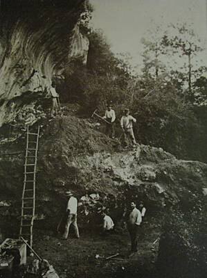
L'abri de Ségognole 3, situé dans la forêt de Fontainebleau et connu des archéologues depuis les années 1980, est un site du Paléolithique supérieurPaléolithique supérieurDernière phase du Paléolithique (env. 45 000 à 10 000 ans), marquée par Homo sapiens en Europe, l'art, les parures et une succession de cultures (Aurignacien, Gravettien, Solutréen, Magdalénien).→ ayant livré des gravures pariétales et de la faune fossile. C'est lors d'une ré-analyse minutieuse du sol de l'abri que les géologues Médard Thiry (Mines ParisTech) et Anthony Milnes ont identifié une structure creusée dans le grès quartzitique qui ne ressemble à aucune trace naturelle connue. En cartographiant précisément la topographie du sol, ils ont mis en évidence un réseau de canaux et de reliefs miniatures qui correspond remarquablement à la géographie actuelle de la vallée de la Seine, de l'Essonne et de leurs affluents.1
Avant cette découverte, la plus ancienne carte tridimensionnelle connue était une plaque de roche gravée de l'âge du BronzeÂge du bronzePériode protohistorique succédant au Néolithique, marquée par la métallurgie du bronze (alliage cuivre-étain) et l'essor des premières cités et États ; en Égypte, elle correspond à l'époque des premières pyramides.→, datant de 3 000 ans environ. La maquette de Ségognole 3 repousse cette limite de 10 000 ans, et s'inscrit dans le contexte de la fin du Tardiglaciaire, une période où les populations du Paléolithique supérieur avaient développé des cultures matérielles et symboliques sophistiquées, comme en témoignent les peintures rupestres de Lascaux ou les statuettes de Vénus.
Des représentations spatiales au Paléolithique
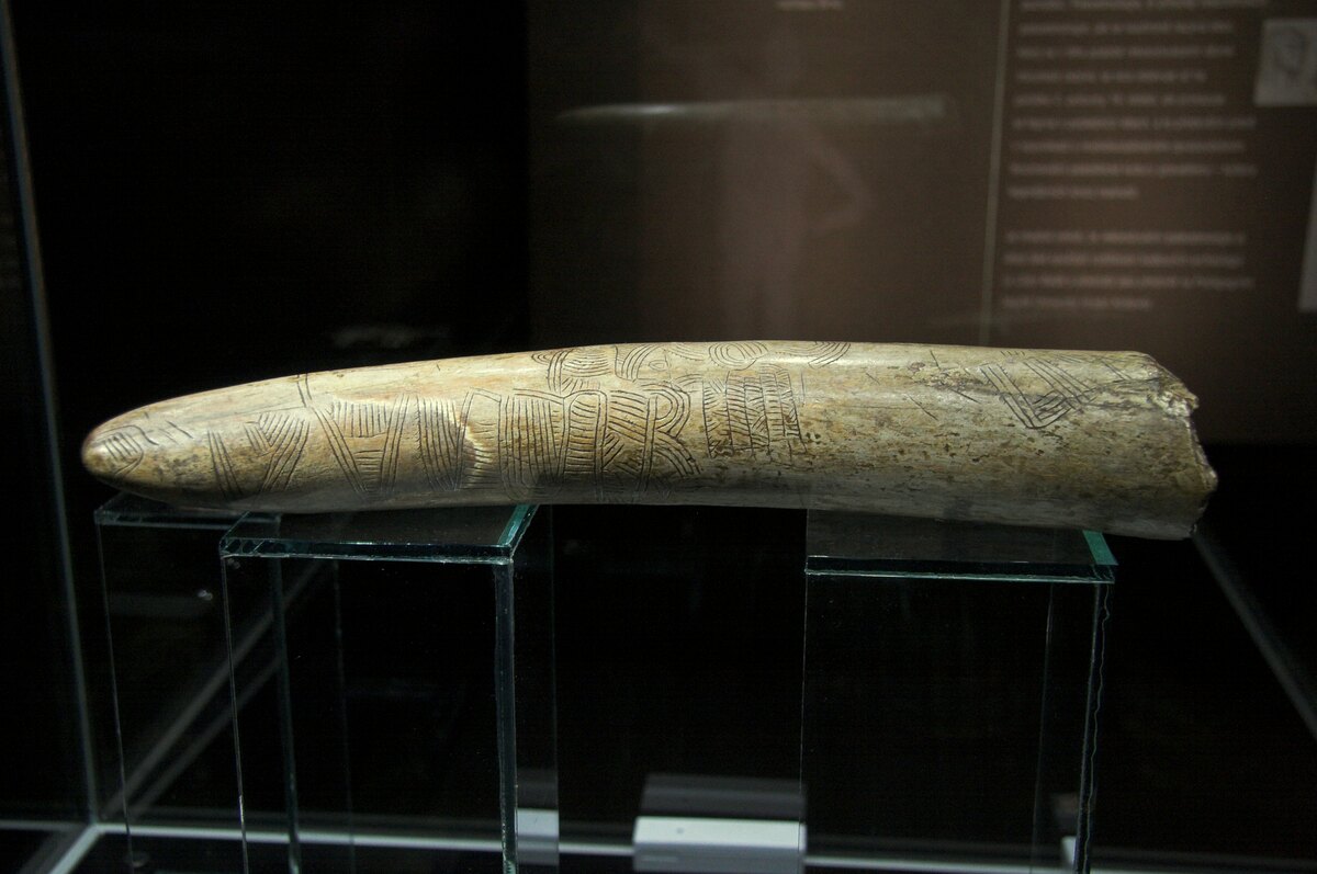
La carte de Ségognole n'est pas sans précédent total dans l'archéologie préhistorique. Plusieurs objets ont été interprétés comme des représentations spatiales ou cartographiques dans d'autres contextes : des gravures sur défense de mammouth au Gravettien, des marques sur os interprétées comme des relevés de territoire. Ce qui rend Ségognole 3 unique est l'échelle : il s'agit d'une représentation tridimensionnelle permanente, creusée dans la roche, à une échelle relative qui permettrait une navigation ou un repérage concret.2
Cette interprétation reste débattue au sein de la communauté archéologique. Certains chercheurs soulignent la difficulté de distinguer des formes sculptées intentionnellement de l'érosion naturelle du grès, et appellent à des analyses complémentaires (datations par OSL des sédiments piégés dans les gravures, étude traceologique des surfaces). Les auteurs de la publication répondent que la correspondance entre la topographie gravée et le réseau hydrographique réel est trop précise pour être fortuite, et que les marques de taille observées au microscope excluent une origine naturelle.3
Une cognition cartographique préhistorique
Quelle que soit l'issue du débat scientifique, la découverte de Ségognole 3 illustre une réalité que les études cognitives récentes confirment : les humains du Paléolithique supérieur possédaient une pensée spatiale élaborée, capable de conceptualiser un territoire, de le représenter et de l'utiliser comme outil de navigation ou de transmission de savoir. Cette capacité cognitive, qui est l'une des bases de toutes les civilisations ultérieures, était donc déjà pleinement opérationnelle chez les chasseurs-cueilleurs de la forêt de Fontainebleau, il y a 13 000 ans.
Ce qui me fascine c'est le lien entre représentation spatiale et abstraction symbolique. Une carte implique de pouvoir 'sortir' mentalement du territoire pour le voir d'en haut. C'est exactement le continuum cognitif dont parle Conard — et ça remet en question l'idée d'une rupture nette avec le Paléolithique antérieur.
Je connais bien Fontainebleau pour y avoir randonné plusieurs fois, mais je n'avais aucune idée de ce que cachaient certains abris rocheux. Je vais me renseigner sur les visites guidées archéologiques dans la forêt. Est-ce que le site de Ségognole 3 est accessible au public ?
Merci pour cet article ! Je travaille en ce moment sur un projet interdisciplinaire avec mes collègues de maths et d'arts plastiques sur la représentation de l'espace. Cet exemple est parfait pour montrer que la pensée cartographique ne date pas d'hier — ni même d'il y a 3000 ans.