An underwater mapping campaign conducted in the eastern harbour of Alexandria, Egypt, has produced the most detailed map ever made of the submerged remains of the famous Lighthouse of Alexandria, one of the Seven Wonders of the ancient world. The Franco-Egyptian team of the Institut Européen d'Archéologie Sous-Marine (IEASM) and the Egyptian Ministry of Tourism and Antiquities has identified and located 43 monumental blocks of pink Aswan granite, some weighing more than 70 tonnes, lying scattered on the floor of Abu Qir Bay and the eastern harbour1. The precision of the new mapping, based on high-resolution multibeam sonar imaging combined with targeted dives, makes it possible for the first time to envisage a digital reconstruction of the monument of unprecedented fidelity.
The Lighthouse of Alexandria, a lost wonder
Built during the reign of Ptolemy II Philadelphus, between 280 and 247 BCE, the Lighthouse of Alexandria was one of the most impressive structures of the ancient world. Literary sources describe it as rising between 100 and 150 metres in height, which would have made it, after the pyramids of Giza, the tallest artificial structure of antiquity. Erected on the island of Pharos in Alexandria Bay, it guided ships towards one of the most active commercial ports of the ancient Mediterranean for more than a millennium.
The lighthouse was progressively damaged by a series of earthquakes that struck the Egyptian coast between the 10th and 14th centuries. The earthquake of 1303, one of the most devastating in the history of the eastern Mediterranean, caused considerable destruction. In 1480, Sultan Qaytbay built on the ruins of the lighthouse the fortress that now bears his name, reusing the ancient building's blocks for its foundations. This reuse explains the presence of numerous Aswan granite blocks in the foundations of the Qaytbay Citadel, confirmed by mineralogical analysis2.
43 monumental blocks mapped with precision
The IEASM mission, which has a long tradition of underwater excavations in Alexandrian waters since the 1990s, conducted this new campaign using state-of-the-art acoustic imaging technologies. High-resolution multibeam sonar allows the creation of three-dimensional models of the seabed with centimetre precision, revealing details invisible during traditional dives. This approach made it possible to identify 43 large blocks whose mineralogical characteristics (pink Aswan granite), dimensions and surface treatment link them to the ancient lighthouse or the pharaonic monuments incorporated into it.
Among the newly mapped blocks, two bear fragmentary hieroglyphic inscriptions mentioning the name of PharaohPharaohThe title of the ruler of ancient Egypt, regarded as a living god guaranteeing cosmic order (Maat), supreme head of state, army and worship.→ Ramesses II (c. 1279-1213 BCE), who predates the Ptolemaic lighthouse by more than a millennium. This discovery confirms what earlier surveys had suggested: the Ptolemaic builders incorporated into the lighthouse construction blocks recycled from older Egyptian royal monuments, a common practice in the ancient Mediterranean. Further epigraphic analyses on these blocks are underway to precisely identify the origin of these spoliated elements3.
Towards a digital reconstruction of the lighthouse
The data from the new campaign, combined with ancient textual descriptions (Strabo, Pliny the Elder, al-Idrisi), iconographic representations on Alexandrian coins and mosaics, and architectural analyses of the identified blocks, have allowed the team to propose an updated and more precise 3D digital reconstruction of the lighthouse than previous models.
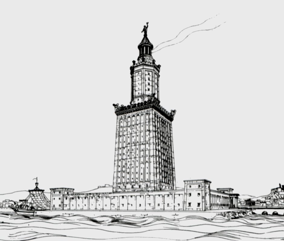
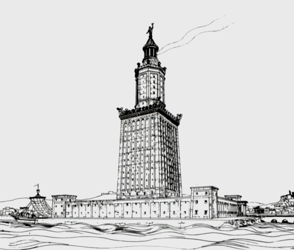
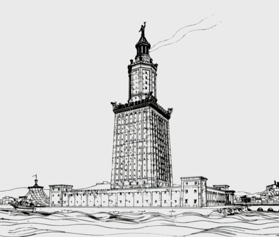
This reconstruction confirms the tripartite structure of the monument described in ancient sources: a large square base, an octagonal intermediate register, and a cylindrical top crowned by a lantern and a statue. The total height, calculated from the architectural proportions of the recovered blocks and textual data, is estimated at between 115 and 135 metres. A large mirror or polished metal surface inside the lantern would have amplified the firelight to project it out to sea, allowing navigators to locate the harbour from several tens of kilometres away.
The mission also documented less well-known underwater structures in the immediate vicinity of the lighthouse: submerged Ptolemaic quays, harbour protective moles, and a group of royal statues, one of which may represent the river-god Nile. These discoveries confirm that the immediate area of the lighthouse was a densely developed monumental space, whose visibility and grandeur served to impress travellers arriving by sea in the city founded by Alexander.
No comments yet. Be the first.